
Pic above: Very Narnia, wouldn't you say? This is a pic of early in the hike, going along the Castle Pass PCT Trail. Stunningly beautiful, I thought, and quiet, quiet, quiet. Just the crunch of my boots and the rustle of my pack.
Weather: a stunning "blue bird" day, as the snowboarders say: sunny, low 40s, no wind, no clouds, just plain ol' gorgeous. A great day to explore winter hiking with new gear.
Stats: The Top Trails book suggests starting this hike at the Boreal PCT trailhead, but that trailhead charges you snow-park parking rates after Nov 1, so I parked instead across 80 (well, under 80) at the Castle Valley Road trailhead. It added about 2 miles to the hike, but I wanted to do a longer hike anyway.
There's an I-80 rest-stop on the Castle Peak side of 80 just before you get to Boreal exit. There's no unattended cars allowed at that stop, however. Instead go to the PCT trailhead (if before Nov 1) by Boreal, and park there instead. The PCT start makes the hike a little over four miles.
If it's past Nov 1, then just drive under the freeway at the Boreal exit, and then park along the side of the Castle Valley Road; then you can walk up the (dirt) road a mile or so to the junction with the Donner Lake Rim Trail (off to the right through a meadow). The Castle Valley start made it 6.5 miles--perfect. 3 hours with only a few photo stops and one or two changes in trail plans along the way.
Gear: Since it was my first real winter hike, I was anxious to see how the gear would perform: Keen Waterproof Targhee II Cross-Trainer shoes, OR low gaitors (with red straps), REI Mistral pants (waterresistant, windproof, softshell), base layers, synthetic t-shirt, light fleece, REI Mistral soft-shell, SmartWool beanie, Swix gloves, handwarmers.

Poles were really helpful on this hike in particular; they helped me decide which piles of snow were just snow or instable rock or stable rock--all of which were helpful pieces of info when crossing small streams and rockbeds along the way.
I started out the hike in all the gear but, as I warmed up, spent most of the day in just the fleece and base layers on top; all of the gear worked splendidly, and I learned that, with the right gear, a sunny snow day-hike can be really great.
My feet were warm and dry in the Keen shoes, with no hotspots whatsoever, and the gaitors worked out very well keeping the snow away from the tops of my shoes. I only have low gaitors, and I was in 4-5 inch snow; the knee high gaitors, I think, could be overkill for most day-hikes; perhaps they're for mountaineers. Of course, I didn't explore Castle Peak with snow, so who knows?
Handwarmers and good winter gloves made my hands and fingers sing for the first half of the hike (when I no longer needed gloves); chemical hand-warmers last about seven hours and weigh next to nothing; they're well worth bringing along.
Pants were very comfortable (wind proof, water resistant, soft shell with fleece lining) although I realized that I need a belt to keep them exactly in place as the hike progresses.
Below: the view from early in the hike on the Castle Pass PCT trail: while tiny parts of the hike was on wet trail, most of the hike had snow around 4-5 inches, a mix of icey crunch and powder--delightful and a great workout.


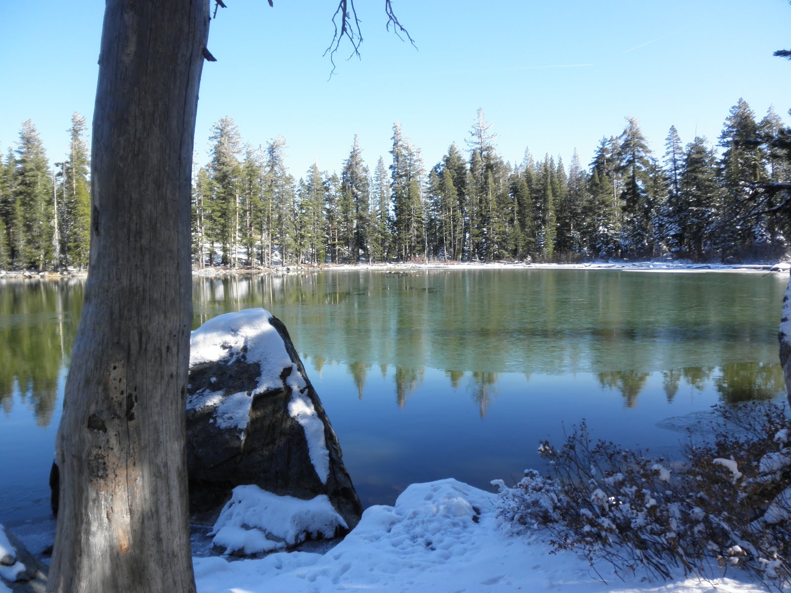
Below: pix of Summit Lake--summit to see, indeed. Not another soul in sight, no critters to be seen or heard, just me and the lake and the sun. Wonderful. It's not that high a lake by Tahoe standards, and it's not a huge one either, yet it's still worth the hike.


Below: The hike is quite well-signed, with periodic small Donner Lake Rim Trail signs affixed to trees as a comforting touch. I always take with me, though, a xerox of the map from Top Trails, just in case the posted signs don't mesh with my expectations.


On the way back to Castle Valley from the lake, there's a three way junction about 2 miles from Summit Lake; at that three way junction (one to the I-80 rest-stop, one back to Summit Lake, and one to Castle Pass), take the Castle Pass trail to get back to your car on Castle Valley Road.
I learned also that on snow-covered trails, it's good
a) not to be the first person on the trail since the snow fell and
b) you have to believe that the footprints into which you're treading (cue King Wencelas from the carol) are going to your destination. It pays to pay attention to surroundings, of course, to ensure that the footprints are heading at least in a feasible direction. You don't want to follow a crayzee off trail person, after all.
Ponderings about the hike:
It wasn't deep enough for snow-shoes although I can see how snow-shoes will be fun. That's definitely for my to-do list--try snowshoeing this year.
The trail is as close to Boreal as you can be and not be at Boreal. Very convenient if you have skiers/boarders in the family but you don't ski or board. No snowshoe or X-country at Boreal, but there is some X-C at Royal Gorge which is only a mile or so away from Boreal. Hiking always available at Castle Pass, however.
I can see how crampons (or some kind of additional grip sole for boots) could come in handy going up a steep hill--Castle Peak, say, or Ralston.
It's fun to look at animal tracks in the snow; I saw several coyote print trails and lots of smaller animal trails along the way. Cool.
Next Boreal day-hike is Peter Grubb hut.
More info about Summit Lake: http://gorp.away.com/gorp/resource/us_national_forest/ca/tahoe_trails/summitla.htm
No comments:
Post a Comment