Sunday, May 8, 2011

Stevens Trail South, Auburn State Recreation Area


Above: a view from the trail of the roiling North Fork of the American River, boisterous and quick flowing due to all the snow melt in the last few weeks.


Maria and I decided to return to the Auburn State Recreational Area for this hike because we wanted to explore Stevens Trail South, the trail they call the "forgotten side" of Stevens Trail, and what an adventure it turned out to be.


To get to the trail, you drive to Colfax, and use the Canyon Way exit, and then turn on Iowa Hill Road. This little road will lead you past the Mineral Bar Campground along the bridge you can see from Stevens Trail South.

Below: A view from the suspension bridge we saw from Stevens Bridge North on our last hike. This view is looking back up to the North Trail.


Once past the campground, you drive up a squirrelly little one lane windy road until you reach the Iowa Hill Store.

To the right of the store, you'll see, set back a little, the trail sign (above). It's an unassuming start to the trail, but it's well worth the trip.


Once we reached the store and the trailhead, we found plenty of parking (opposite the store), and we also found ourselves surrounded by several large and friendly dogs, with a pit bull appearing to be particularly excited to see us arrive. As we unpacked our gear, a young man from the store emerged and asked us if we'd like to bring the dog along with us on our hike.


We're unsure what to say to his offer because we don't know this dog at all. The dog is a pit bull but appears to be very friendly and extremely enthusiastic about the upcoming walk. As we wondering what to say, the man further notes that the dog will keep bears away, and since that seemed like a reasonable argument to us, off we all trundled down the trail, with the pit bull, named Shorty, leading the way.


The trail starts out right by the store, but travel about 200 yards, through the forest, and then you pop out onto a southwesterny type of trail, lined by colorful river rocks, and altogether a delightful surprise.

Below: Beginning of trail--a southwesterny type of trail--well maintained and clearly signed.


Below: You can see an exuberant Shorty, galloping toward me at the start of the trail. At this point, I was wondering what we had gotten ourselves into with our guide, but it turned out great. :)


The trail continues, well marked, but soon transforms into a shaded, foresty trail for almost the entire way with periodic glimpses down to the North Fork of the American River about 1500 feet below.

Below: View of North Fork of American River from trail:


Throughout the hike, Shorty was a wonder. He led us throughout the entire trail; he would bound ahead, check things out, and then come back to check on us. Very sweet and great company, and we felt safe with him.


Now--I don't know if you've seen bear scat before, but I hadn't before this trail. We saw a few impressive examples of bear poop on this trail, and all I can say is that that animal is HUGE with a hefty appetite. The poop looked fairly recent, and it was good to know that Shorty was ahead, disturbing bears away from the trail. We felt probably unreasonably safe with him, but it was a good feeling to have.

If you go on this trail, therefore, and you're offered the hiking services of Shorty, I highly recommend taking the store owners up on the offer.

Shorty's a great dog--big and friendly (although he looks like he could eat your arm off), and he wants nothing more than to keep you company and to lead the way. He didn't beg for food, he drank from the creeks and from the river, and he was a great guide. He even has his own business card. :)


Below: I don't know what Shorty was looking for in the trees, but he spent a lot of time peering up into the branches along the trail.


The trail belongs to the Bureau of Land Management, but it appears that economic cuts have prevented their visiting the trail recently because there were about six downed trees, over which we happily scrambled through, over, and under, along with some eroded trail. It's an adventurous hike, therefore, but a fun one.


Below: The trail is somewhere under this mix of tree branches.


Below: About half way along the trail, you climb a small hillock wit the help of a thoughtfully placed knotted rope. :)

Eventually, at about 3.7 miles of gradual but constant descent, the forested trail pops you out on the shores of the North Fork of the American River, and you realize that you can see hikers on the Stevens Trail North just on the opposite bank. That was a fun perspective to have because Maria and I had hiked that trail a few weeks ago, so we could see what they were seeing. I felt as if we had achieved a 360 view of the trail, having hiked both the North and the South side of the trail.


At this point too, on the river's side of the trail, we found some old thick braided iron cables that, we think, could have been part of the original bridge across the river, joining the two trails together. That was a fun historical discovery for us to find. It helped us realize the intricacies of Stevens' work in the area. He ran a toll trail, maintained it (I guess) and the bridge, and he earned enough money to sustain himself in a decent way of life and then retire successfully. I wonder if he employed the same Chinese workers who built the rock wall on the early part of the Stevens Trail North.


Below: Maria on riverbank; we went down the bank and scrambled over the rocks to find the perfect lunch place on some flat rocks on the bank. Shorty found some shortcuts around and over the rocks, and he was happy mucking around exploring as we munched on our trailmix and sandwiches.


After lunch, we retraced our trail, with Shorty leading the way, and we realized that the return trip is where we pay the piper--it's all up hill, but not that bad. Just be ready for it. It's easy to forget you're going downhill on the way out because the grade is pretty subtle on the descent.


Once we had returned to the store once more, we could see that Shorty became visibly relaxed, because his charges were at last safe, and we had the chance to chat with the store owners to learn more about our canine guide.


It turns out that Shorty has been hiking for a while but has only recently decided that he's going to accompany all the hikers on the trail, to ensure that they return safely to the store. He's such a sweet dog, and the store owners are great people.


Stevens Trail North Trail vs Stevens Trail South:

The North trail is much more heavily traveled than the South trail; it has a little easier access from the trailhead, and it is more recently maintained. It offers some phenomenal views of the river, and it has unimpeded views of the surrounding canyons and hills. The popularity of the trail, however, means you have to give up some of the feeling of isolation that sometimes you need, and the crowded trailhead can mean some creative parking solutions, I think.


Still, those North Trail unimpeded views will translate into some hot hikes once the summer comes, and so the South trail is well worth a visit. It's a shaded trail for most of it, so it's good in summer, and it's more isolated, so it's good that way too. The views are fewer between, but they're also phenomenal, and ultimately, you get to have a quiet, isolated lunch, across the river from the crowded trail, and feel special that way, because you really did take the trail less traveled, and that does make all the difference (with apologies to Robert Frost). :)


Trail Stats:

Length: 3/7 miles to the river; about 7.5 miles total. Allow extra time for working through the downed trees and bouldering on the rock bank.

Weather: predicted to be showery, but dry. Mid-60s and sunny for the past, so great hiking weather.

Trail: duff, loam, some rocky gravel trail about 200 yards in. Forested for the most part.

Animals: definitely bear territory. I wouldn't go alone unless you're like the Grizzly Man. Do accept the store offer of Shorty, who's no trouble at all and is great company.


Monday, April 4, 2011

Stevens Trail, Colfax CA April 2011 II


Above: Wonderful view through the flowers to the North Fork of the American River, from the Stevens Trail. (Thanks, Maria, for the pic!)


After a few weeks of colds, flu, and vertigo, Maria and I finally made it out the foothills today. We were originally going to walk the Euchre Bar trail, but we discovered it was still under 18 inches of snow/ Instead, we drove back down the hill for 30 mins, and happily settled on walking the famous Stevens Trail near Colfax--an old, popular, and well maintained trail which offers tremendous views of (and ultimately access to) the North Fork of the American River. It's a great trail, and only about 70 miles drive for us from Sacramento, which makes it even better. :)


The weather was perfect--mid-60's to low-70's, a little breeze when you needed it, and plenty of sunshine.


Above: Welcome to the Stevens Trail trailhead.

The trailhead is large and overtly signed, but note that the 60 Hikes within 60 Miles of Sacramento book has a small but important error in the location of said location; it's on Canyon WAY and not Canyon Court (FYI).


The parking lot can fit probably 20 or so cars, with plenty of overflow parking on the street. Pay attention to the parking signs if you use the overflow parking, however. You may only park on the north side, I think, and it would be a bummer to get a ticket after a great hike.


The trail used to be a toll footpath between 1871 and 1906, and it took walkers between Colfax and Iowa Hill. It's a rare type of trail because, although it takes hikers down 1200 feet to the river's edge, it doesn't use any switchbacks. Instead it uses "gentle engineering" which results in a modest slope for the entire trail. A great break for the knees. :)

Above:Here, I'm standing on the table rocks just before the (rather precipitous) waterfall on the Stevens Trail.

Trail type varies, but is mostly dirt and rocks, with some shale slopes mixed in. There are some shady parts, but it's exposed for the most part, so take some block. It's a well maintained, well signed, and well traveled trail. Slopes are about 6% average, with 40% max, but it's really a fairly moderate hike, overall, in terms of difficulty.

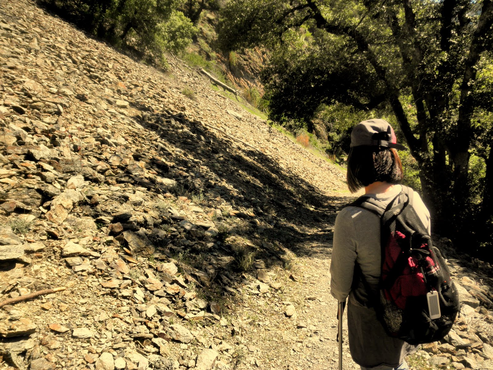
Below: here are some pics of the shale part of the trail. Just above this shale slope is a yellow brick wall, built by the Chinese laborers back in the early Gold Rush, to retain the railway track that runs (or used to run?) above the river.


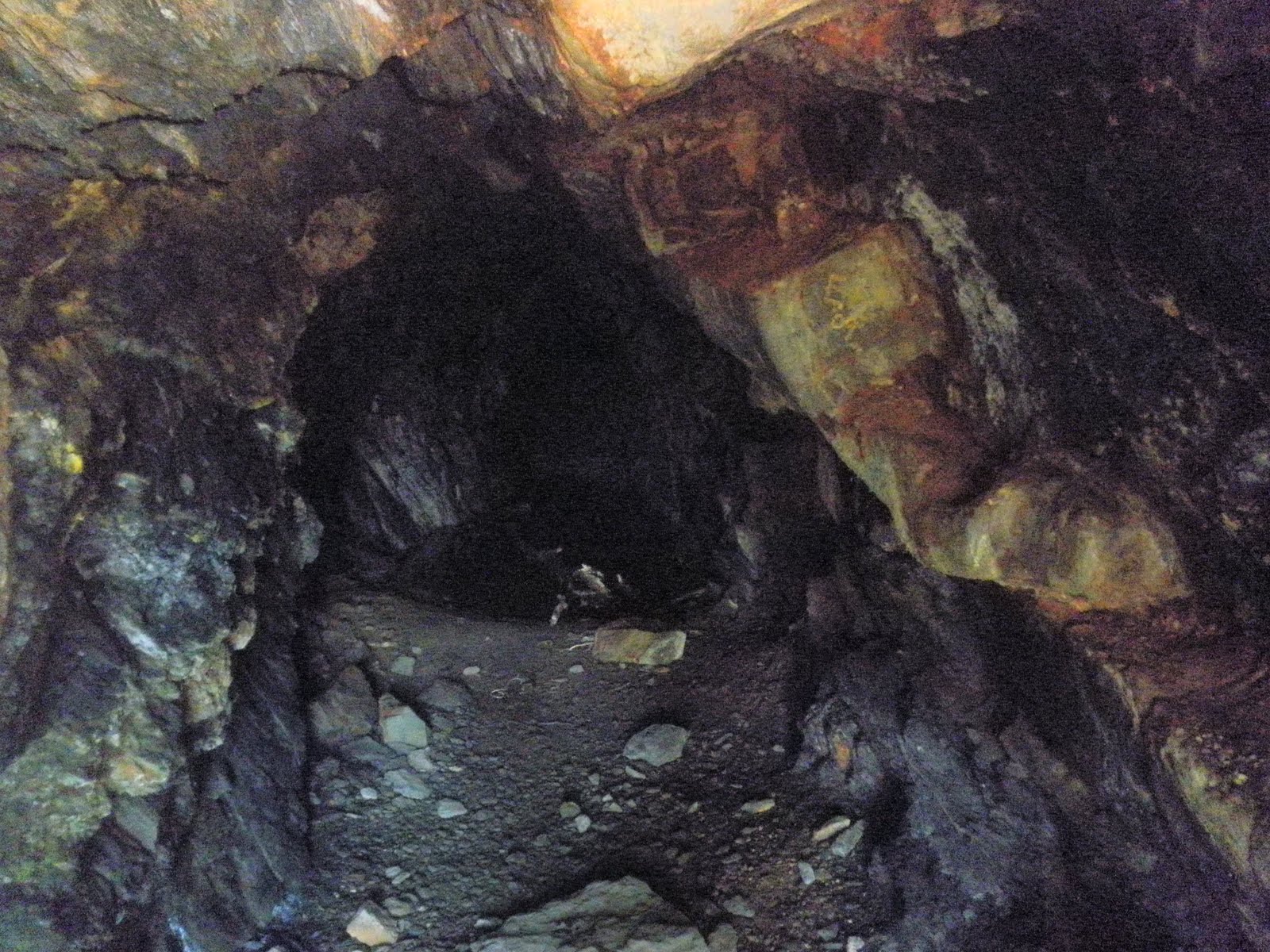
Below: Along the way, you pass an old gold miner's cave. It seems to go back a long way, but it's likely dangerous to explore too far in.


Below: On the way down the trail, and it's mostly down on the way out, but it's a fairly subtle slope for the most part, you can see the river down below:


Below: And here again--a high view of the river, this time with some beautiful lupins--flowers are abundant at this time of year:


Below: this is the bottom of a largish waterfall, the falls larger than normal because of the recent rains. It's about 30 mins from the beginning of the trail, and you have to cross it to continue the hike.

See that small shiny (wet, slippery, treacherous) rock in the middle of the water? That's your stepping stone to the other side. You can also see on the right the rather precipitous fall down the hill and how there really isn't too much margin for error. Additionally, in the middle top of the pic, you can see the tricky sharp, pointy, wet landing rock. :)

It's not normally, I understand, this submerged, but since it can be, just take your time crossing.


Below: Once you survive the waterfall crossing, you walk down further along the trail, and you are rewarded with this view for a lunch time breather.


Below: with all the rains recently, even the small feeder creeks are running strongly, as they rush down to replenish the American River.


Trail Stats:


  • The trailhead sign notes that it's 4.5 miles each way--9 miles total


  • Dirt and rocks for trail surface. About 1200 feet elevation loss along the trail.


  • Well maintained and signed overall; one early fork where you needed to keep to the left and go over a small hill to find the trail.


  • About four hours, including lunch and pic pauses.


  • Popular trail--good for solo hikers.


  • About 70 mins past Sacramento-an easy drive.
Want to learn more?
Link to Auburn State Recreational Area


Sunday, January 23, 2011

Barnabe Peak, Jan 2011

Above: me enjoying the eastward view from the top of Barnabe Peak.

Last week, Maria and I went on a great hike to Barnabe Peak, a 1400 or so ft peak near Point Reyes, in the Samuel P Taylor Park. On the way, it was pretty foggy, but the fog has often cleared on the coast, so, on overcast days, it's worth driving from the valley to the coast for a clear hike.

Barnabe Peak is a great little hill on the coastal range, and it had been on my list for a while, so I was happy to hike there this beautiful weekend.

Above: Devil's Gulch trail-head--the start of our Barnabe Peak hike and the way to access Bill's Trail--the trail up to our destination.

Bill's Trail is a very gentle trail which meanders through a large number of switchbacks; (some web hikers complain about the number of switchbacks, and there do seem to be an awful lot--easy on the knees, however, so pros and cons).

The trail, however, leads you though a damp, Hobbity-type of mossy forest, filled with water features and two waterfalls. One of the waterfalls, Stairstep Waterfalls, was flowing pretty well, and looked enchanting, sitting in the middle of the forest. The trail was pretty gentle, with plenty of switchbacks in the forest to soften any elevation gain. The forest was damp, mossy, and leafy, and a great place to be.

Above: one of the several water features on Bill's Trail this past weekend. After a pretty wet winter so far, the waterfalls and creeks were active and flowing--it made for a fresh, damp experience in the woods and plenty of green.

Above: a sampling of the well maintained Bill-Trail.

After about 3 miles of forest and shade (great for a summer hike), the forest trail eventually pops you out onto some welcome sunshine and great views.


Above: the increasing light and thinning forest makes the end of Bill's Trail a ray of sunshine. :)

Above: the view looking west as Bill's Trail leads to the Barnabe Peak trail.

Above: The Barnabe Peak trail on the south side of San Geronimo Valley--14.7% grade, so fairly steep. Great to do in the cooler months; probably too exposed for summer, however.

Above:: The Barnabe Peak trail, winding its up the hill toward the peak.


Above: We made it! Me enjoying the view from Barnabe Peak, looking east toward perhaps Mt Tam? Either way, a beautiful view and a perfect hiking day.

Above:Maria, enjoying the north west view from the fire tower rocks at the top of Barnabe's Peak.

Up there also is a camouflaged cell phone tree; it looks pretty realistic. The fire tower is unmanned but well maintained. We heard an engine noise up there from something, but for the most part, the peak was quiet and preserved and a great view.


Above: One of our reptilian companions on Barnabe Peak.


Above: a sign to Bill's Trail as you come back down from the peak and look northwest. We took the trail to the left of this sign--Gravesite Trail, it turned out, and actually, closed as it turned out too. The sign did state that it was closed for ecological protection, but the map we had didn't clearly note that the trail we needed was Gravesite Trail. Oh well. I'm always happy with additional miles. :)


Above: The trail coming back down from Barnabe Peak, as we walk past Bill's Trailhead and look for the Gravesite Road trail.

We had some minor map confusion as we eventually realized that the trail we needed (Gravesite Trail) to get back to the car at Devil's Gulch was closed at this time of year to protect the plants. No worries; we just walked to the Madrone Group Picnic Area, and then crossed the road, walked back through the campground to the dump station and then onto the North Creek Trail, back to Devil's Gulch.


We could probably also have achieved basically the same goal by continuing, from Barnabe Peak, on the fire-road toward the southeast. It would likely have popped us out at about the same campground area. No problem; I'm happy to add miles to a hike, I'm not wild about hiking on fire-roads, and we still found the car but with a gentler grade going down.

Walking back through the campground to the North Creek Trail, we saw proof positive, if we needed any, that light travels in straight lines:


A great day overall, with great views and fun company. I'm happy to be back hiking again with strong knees and a spirit that longs for long views and continuing hikes. :)

Trail Stats:
Mileage: about 10 miles
Elevation gain: 1400 ft or so
Weather: clear, sunny, mid 60s--in January!
Trail: dirt, single-track, some fire-road up to the peak. Well maintained. Signed well but take a map anyway.

Want to learn more?
Here's another hiking blog review: http://www.redwoodhikes.com/Taylor/Barnabe.html
And one more: http://kevingong.com/Hiking/200206BarnabePeak.html.
Finally, here's the BAHiker page for the hike:http://bahiker.com/northbayhikes/sptbarnabe.html

Sunday, September 12, 2010

FAQ: How do you find hikes to hike?


Before I started hiking, one of the reasons I didn't hike was because I couldn't figure out how to find the hikes themselves. I always wondered how people knew about these hikes and how they knew where the trailheads were.

Here's the 'secret': we use hiking books (and now we use the web).

My favorite trail series by far is the Top Trails series; I have the Top Trails for Sacramento:


and the Top Trails for Tahoe.


Both the books offer specific accurate info on mileage, difficulty, trailhead location, elevation, and trail conditions, and both books offer a wide variety of hikes to suit all hiking experiences. I really enjoy reading them and planning my next hikes. When I do go hiking, I copy off the relevant pages (so I don't have to bring the entire book), and then use it (along with maps) to confirm any questions I have on the trail.

Now, how do you find people with whom to hike? If you're like me, you know plenty of people who love hiking but whose schedules hardly ever jibe with your own. The problem, therefore, is not necessarily a lack of hiking companions but rather schedule coordination with those folks. One easy answer to finding company on the trails is, assuming that you enjoy hiking with others, to join a hiking group.

I've found Meetup groups to be a great source of friendly hikers who accommodate a wide variety of fitnesses and experiences. Yahoo groups and Sierra Club groups also work, along with other hiking groups that are specific to a region. Most groups are very active, with hikes at least weekly, and they're mostly flexible. Joining a group doesn't require that you attend any specific number of hikes or lead any hikes. It just means that you can choose to have company on the hikes.

If you're traveling, and you'd like to hike there, you can join up with a hiking group for that area, and tag along with those friendly folks while exploring the local area. The groups tend to go to the classic hikes in the area (because they want to find wonderful scenery t00), and it's well worth planning to join them on the trail. To find groups, just type in 'hiking group" and your region; Google will offer you some options for groups to join. I highly recommend that route.

Even if you don't join the group, it's worth reviewing their hiking calendars to see where they go (and when). Hiking in the 'correct' season can make the difference between enjoying a pleasant hike and slogging through the mud or snow.

So, just FYI. That's how I do it anyway. :)


Carr Lake to Grouse Ridge, Sept 2010


Above: Carr-Feeley Trailhead reachable only via a two to three mile four wheel drive dusty bumpy road. It's worth it, but I would only drive it with a four wheel vehicle with decent clearance. Once you get to the trailhead, parking is tight along the side of the this four wheel road.

For this hike, we explored an area I hadn't been to before (although I'd heard some great things about it from others). I went with the hiking group, who are such welcoming people and fun hikers, and we set off from Carr Lake at the Carr Feeley Trailhead. It was a beautiful day, and I was thankful to have the opportunity to hike with friends in such a stunning area.

The trailhead pops you out on a spit of land between Carr Lake and Feeley Lake, and as I started out on the hike, I realized that it's not for naught that people call this area the "land o' the lakes o' the west." It's possible to pass by seven lakes and see fifteen lakes, all beautiful, all alpine, and all within a ten mile hike along this trail.

Since I'm a sucker for a beautiful alpine lake, I was very impressed with the whole area's access to these wonderful waters. :)

Below: Island Lake. The third lake after only a few miles on the trail. People camp along its shores (and on the island itself), and it's a stunning lake. Worth a visit.


Below: Me on the shores of one of the many lakes along the trail. See I'm wearing my trusty REI Stoke 19 and using my Leki poles? I use them ALL the time; they're great. Couldn't hike without them. (Well, I could, but it wouldn't be so easy and efficient.)


Below: Feeley Lake--the second lake on the trail. We landed at Carr Lake, which was itself beautiful, and then very quickly, the trail takes you past this little stunner of an alpine water-hole. Very nice.


Below: Mapping the route, of course. It's always good to have a decent map with you. I used the National Geographic series for this area. Trails are typically easily found and followed, but there were a few spurs that could throw you off track if you're not careful. Even withe well signed trails, however, it's still helpful, I think, to have a decent trail map and compass (and map and compass skills) with which to supplement GPS and signs.


Below: the famous Grouse Ridge outhouse outlook. You can sit here in here for pictures. :)


The outhouse is at the very top of Grouse Ridge, which is reachable two ways--either via a tallus field, which is tricky but fun, or up the Forest Service dirt road, which is easy, but not so interesting. You can reach either routes from the top of Grouse Ridge, which itself is accessible via trail (from Carr Lake) or by car from 20.

Below: Next to the outhouse are remarkable views of the area around, including on a clear day, Lassen and the Sierra Buttes.This pic is taken looking away from the monitoring station an and behind us is a view that goes on forever.


The outhouse is situated on the ridge next to the Forest Service monitoring station (monitoring the weather? fire outbreaks?) The monitoring station has a wrap-around porch, which is nice to sit on for lunch. The wind was pretty significant on the ridge, and the station offered some shelter and some shade for lunchers, along with a pretty magnificent view.

Trail Stats:

  • Access: 80 to 20 to Bowman Lake Road to Carr Lake Trailhead. About two hours from home.
  • Trail: mostly packed dirt--easier trail to hike on. Not too much elevation although the hike up to the Ridge is the steepest part (+1000 feet), but the steep part isn't too long and it's not that steep. A relatively easy hike overall.
  • Weather: stunning--blue sky, sun, some breezes. Mid 80s overall. Windy on the ridge, but not cool enough for a jacket.
  • Distance: 8.3 miles, including some wrong ways and accidental explores down some spurs (to Milk Lake, for example).
  • Elevation: Carr Lake: 6703 ft; Grouse Ridge: 7550 ft. Total elevation gain (modest): <1000>

Further notes:

  • Take your camera; I forgot mine, and while it was liberating in some ways not to be tied to a camera, I'd rather have one with me to record the hike. These pics are from a colleague in the group.
  • Take your map and compass. It's best to be prepared.
  • No permits necessary.
  • You can also park at the top of Grouse Ridge and do the hike in reverse, which would be equally beautiful and possibly easier (road-wise) on your car.
  • It's a popular trail, so be prepared to meet others on your hike. A good hike to do solo, however, since others would be around to witness any demise. :) Not a hike, however, for people who want to feel isolated (unless you go possibly on a weekday?)
  • As always, take water with you; there are pit bathrooms, but I didn't see/notice any faucets.
  • The lakes belong to PG&E which cares for and maintains the lakes. You make camping reservations, I think, however, via the Tahoe National Forest.

Saturday, September 4, 2010

Echo Lakes to Tamarack Lake August 2010


Above: a view of the snow-melt river at the side of Hwy 50 on the way to Tahoe. I had been meaning to take a picture of this river for many months, and I finally managed to do so. Since it was a clear day, I managed to capture the reflections, which is kind of cool.

On the trail: My Mum was in town for another visit, and since she's a big hiker, I took her to one of our classic Sierra Nevada hikes--Echo Lakes to Tamarack It was yet another stunning Tahoe day as we close out our summer here in Norcal: mid-70s, cloudless sky, pretty windy, however, so we held onto our hats. The wind also created significant movement on the lake surface, so no mirror lake pics this time around.

We arrived at Echo Lakes at about 10, and although it was a Friday, the parking lot was already packed. I think we found one of the last spots. The trails were steadily busy, but there was still plenty of room for everyone, with a good mix of backpackers, day-hikers, and tourists.

Before our hike, I finally had the chance to visit the Echo Lakes store, and inside, I found a good selection of groceries plus the largest selection of Echo Lakes shirts and paraphernalia I've ever seen. Pretty impressive marketing there, Echo Lakes!

We set off on our hike along Lower Echo to Upper Echo, and we both hiked steadily, enjoying the view and the sound of the wind in the trees (which preceded the cooling effects of said wind on some hot hikers).

Below: We had lunch on picnic benches, which I didn't know were there, at the top of Upper Echo Lake, to the right of the water-taxi pier (which was making a killing the day we were there). :)

Below: We finally found Tamarack, which actually isn't that hard to find if you can find the boot-beaten trail. The trail is a little elusive because it blends in with the surrounding granite boulders and flats, but the cairns are pretty accurately placed, and the lake is worth looking for.

Tamarack is really only about 400 yards from the main PCT trail, and it's a sweet quiet little alpine lake--a nice break from the 'hub-bub' of the main trail. :) It seems like a great place to swim if you're so inclined.


Stats:

  • Temp: mid-70s, cloudless
  • Distance: Echo Lakes (Upper to Lower to Tamarack)
  • Drive-Time: About 90 mins from home, off 50.
  • Trail: a good mix of dirt, jagged granite rock gardens, and loose shale, much in the shadow of granite walls on one side and stunning lake views on the other.


This hike was my third hike to Echo; look here for my first (to Aloha) and second.

I typically try to explore new places with each hike, but Echo keeps drawing me back. I think next time, I'll take the water-taxi, and then use the additional miles savings to explore further in the back country--Jabu, for example, comes to mind along with more of Aloha.

Maui: Napale Blowhole


We went to Maui for about a week this summer, and we spent most of our time snorkeling and playing on the beach, but we did manage to fit in a tiny hike to a 'blowhole'--a hole in the coast where the sea surges in and then explodes through said hole. Pretty cool, and a great trip overall.