
 Above: Wonderful view through the flowers to the North Fork of the American River, from the Stevens Trail. (Thanks, Maria, for the pic!)
Above: Welcome to the Stevens Trail trailhead.
The trailhead is large and overtly signed, but note that the 60 Hikes within 60 Miles of Sacramento book has a small but important error in the location of said location; it's on Canyon WAY and not Canyon Court (FYI).
The parking lot can fit probably 20 or so cars, with plenty of overflow parking on the street. Pay attention to the parking signs if you use the overflow parking, however. You may only park on the north side, I think, and it would be a bummer to get a ticket after a great hike.
The trail used to be a toll footpath between 1871 and 1906, and it took walkers between Colfax and Iowa Hill. It's a rare type of trail because, although it takes hikers down 1200 feet to the river's edge, it doesn't use any switchbacks. Instead it uses "gentle engineering" which results in a modest slope for the entire trail. A great break for the knees. :)
 Above:Here, I'm standing on the table rocks just before the (rather precipitous) waterfall on the Stevens Trail.
Trail type varies, but is mostly dirt and rocks, with some shale slopes mixed in. There are some shady parts, but it's exposed for the most part, so take some block. It's a well maintained, well signed, and well traveled trail. Slopes are about 6% average, with 40% max, but it's really a fairly moderate hike, overall, in terms of difficulty.
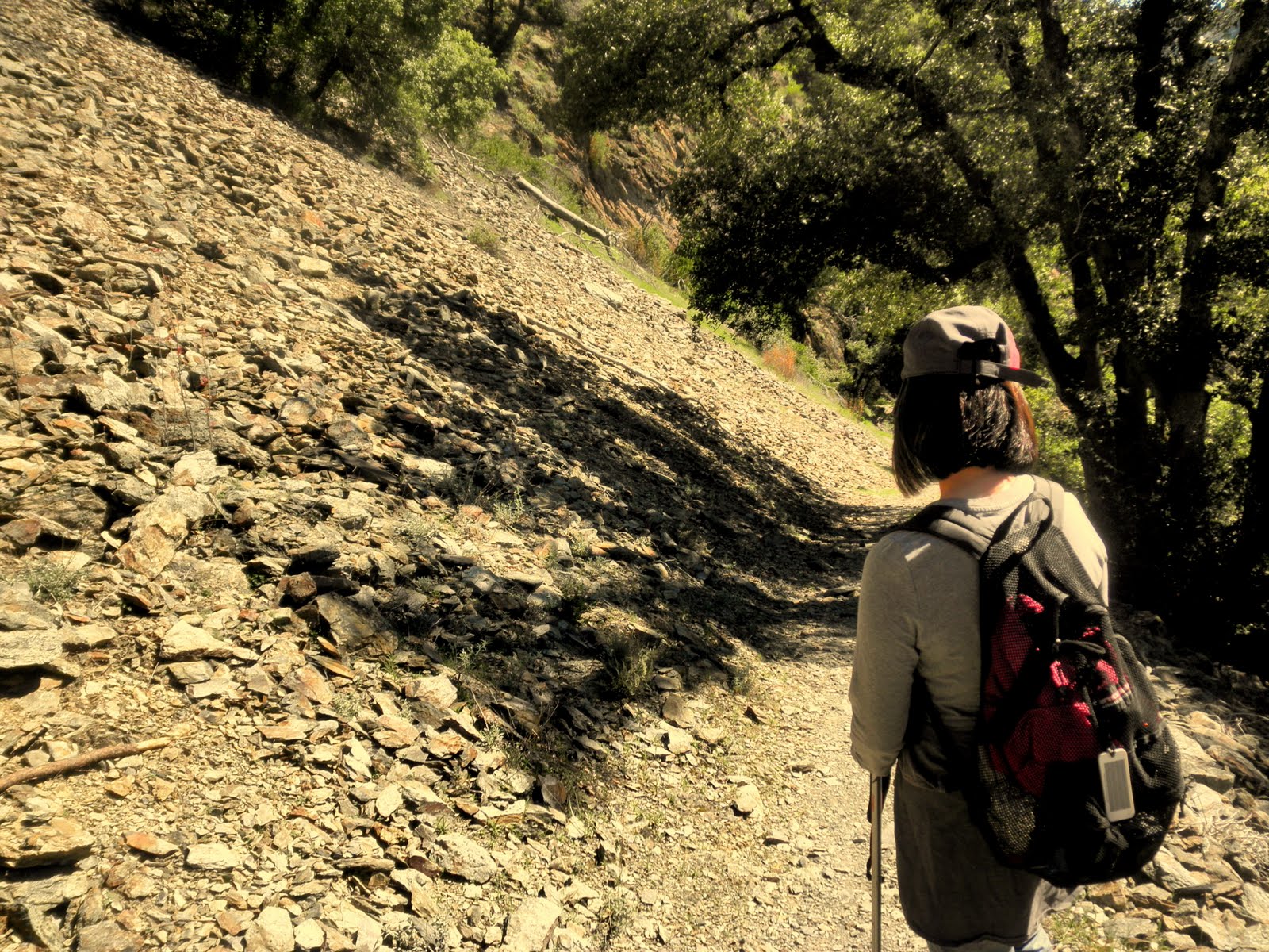
Below: here are some pics of the shale part of the trail. Just above this shale slope is a yellow brick wall, built by the Chinese laborers back in the early Gold Rush, to retain the railway track that runs (or used to run?) above the river.

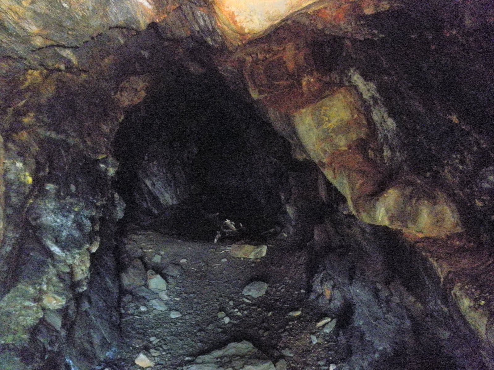
Below: Along the way, you pass an old gold miner's cave. It seems to go back a long way, but it's likely dangerous to explore too far in.
Below: On the way down the trail, and it's mostly down on the way out, but it's a fairly subtle slope for the most part, you can see the river down below:

Below: And here again--a high view of the river, this time with some beautiful lupins--flowers are abundant at this time of year:


Below: this is the bottom of a largish waterfall, the falls larger than normal because of the recent rains. It's about 30 mins from the beginning of the trail, and you have to cross it to continue the hike.
See that small shiny (wet, slippery, treacherous) rock in the middle of the water? That's your stepping stone to the other side. You can also see on the right the rather precipitous fall down the hill and how there really isn't too much margin for error. Additionally, in the middle top of the pic, you can see the tricky sharp, pointy, wet landing rock. :)
It's not normally, I understand, this submerged, but since it can be, just take your time crossing.

Below: Once you survive the waterfall crossing, you walk down further along the trail, and you are rewarded with this view for a lunch time breather.

 Below: with all the rains recently, even the small feeder creeks are running strongly, as they rush down to replenish the American River.
Trail Stats:
- The trailhead sign notes that it's 4.5 miles each way--9 miles total
- Dirt and rocks for trail surface. About 1200 feet elevation loss along the trail.
- Well maintained and signed overall; one early fork where you needed to keep to the left and go over a small hill to find the trail.
- About four hours, including lunch and pic pauses.
- Popular trail--good for solo hikers.
- About 70 mins past Sacramento-an easy drive.
Link to Auburn State Recreational Area