Showing posts with label Desolation Wilderness. Show all posts

Saturday, September 4, 2010

Echo Lakes to Tamarack Lake August 2010


Above: a view of the snow-melt river at the side of Hwy 50 on the way to Tahoe. I had been meaning to take a picture of this river for many months, and I finally managed to do so. Since it was a clear day, I managed to capture the reflections, which is kind of cool.

On the trail: My Mum was in town for another visit, and since she's a big hiker, I took her to one of our classic Sierra Nevada hikes--Echo Lakes to Tamarack It was yet another stunning Tahoe day as we close out our summer here in Norcal: mid-70s, cloudless sky, pretty windy, however, so we held onto our hats. The wind also created significant movement on the lake surface, so no mirror lake pics this time around.

We arrived at Echo Lakes at about 10, and although it was a Friday, the parking lot was already packed. I think we found one of the last spots. The trails were steadily busy, but there was still plenty of room for everyone, with a good mix of backpackers, day-hikers, and tourists.

Before our hike, I finally had the chance to visit the Echo Lakes store, and inside, I found a good selection of groceries plus the largest selection of Echo Lakes shirts and paraphernalia I've ever seen. Pretty impressive marketing there, Echo Lakes!

We set off on our hike along Lower Echo to Upper Echo, and we both hiked steadily, enjoying the view and the sound of the wind in the trees (which preceded the cooling effects of said wind on some hot hikers).

Below: We had lunch on picnic benches, which I didn't know were there, at the top of Upper Echo Lake, to the right of the water-taxi pier (which was making a killing the day we were there). :)

Below: We finally found Tamarack, which actually isn't that hard to find if you can find the boot-beaten trail. The trail is a little elusive because it blends in with the surrounding granite boulders and flats, but the cairns are pretty accurately placed, and the lake is worth looking for.

Tamarack is really only about 400 yards from the main PCT trail, and it's a sweet quiet little alpine lake--a nice break from the 'hub-bub' of the main trail. :) It seems like a great place to swim if you're so inclined.


Stats:

  • Temp: mid-70s, cloudless
  • Distance: Echo Lakes (Upper to Lower to Tamarack)
  • Drive-Time: About 90 mins from home, off 50.
  • Trail: a good mix of dirt, jagged granite rock gardens, and loose shale, much in the shadow of granite walls on one side and stunning lake views on the other.


This hike was my third hike to Echo; look here for my first (to Aloha) and second.

I typically try to explore new places with each hike, but Echo keeps drawing me back. I think next time, I'll take the water-taxi, and then use the additional miles savings to explore further in the back country--Jabu, for example, comes to mind along with more of Aloha.

Sunday, June 20, 2010

Cascade Falls and Granite Lake, Lake Tahoe, June 20 2010


Above: a great pic of Granite Lake--a small but beautiful, granite glacial baisin lake in Desolation Wilderness, opposite Emerald Bay Campground.

Wow. What a stunner today's hike was. It was one of those "hard to believe we were there" type of hikes. Off we went, then, to Granite Lake and Cascade Falls--an easy and beautiful combined hike to do on such a beautiful, early summer alpine day.

Below: our choice in trails at the trailhead.


A note about permits: "Desolation" (on the sign above) stands for, of course, "Desolation Wilderness." You'll need a Desolation permit to go to Granite Lake; you don't need a permit for the Cascade Falls hike (because it leaves Desolation Wilderness).

The permits are usually available at the trailhead, and 12 people can go under any one day permit; if you want to backpack or stay out longer than a day, you need to go to the Ranger Station at Pollock Pines or Mill Run to get your permit there.

I went to the Ranger Station on the way to the hike and picked up a few spare permits for the hikes when you need a permit, but there are none at the trailhead. I also found some great Desolation Wilderness maps which should come in handy on future hikes. It's fun to discover exactly where you are on the map and then be able to identify, with some certainty, the peaks surrounding your position. That way, you can also have a good idea of your elevation too. All good data to have, I think.

We went to Granite Lake first; we'd heard it was the harder trail, but it really wasn't. It was a good starter for the day--dirt trail with a few rock scrambles here and there. A relatively easy warm up, and although its length is not intimidating, if you add in early exposure to altitude and an unpredictable knee, it was a decent workout, after all.

This trail was not very crowded--we saw perhaps two or three other groups along the trail total--despite the huge crowds around the area. This place is a great secret to have. :)

This trail is not a flat trail; expect a steady periodically steep elevation gain which, combined with some altitude of 6600-7800 or so, can make for a decent workout.

Below: Trudging up the Granite Lake trail: you can see it's fairly steep in places.


Granite Lake was worth the hike and elevation gain, however. First, we had some stunning views of Emerald Bay itself.

Below: Here I am at one of the views over Emerald Bay.


Below: the slope you see on the left of the pic below, beyond the bay, is the lower elevations of Jake's Peak:


And then we had the beauty of the Granite Lake itself--pretty much deserted, despite its proximity to Emerald Bay, one of the most popular places in California.

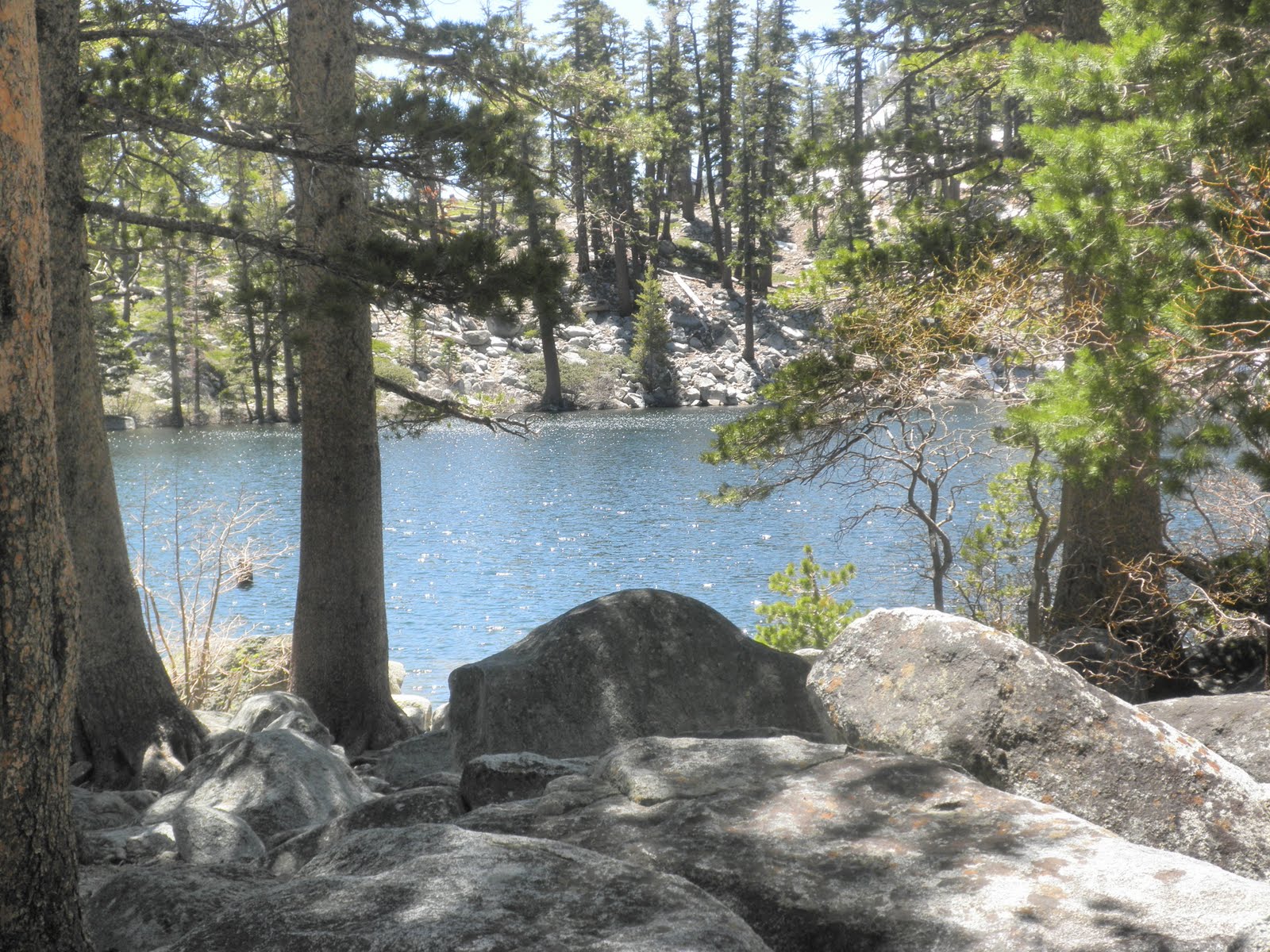
Below: a view of Granite Lake through the trees. . A few patches of snow here and there, but for the most part, the snow remains only at around 7800+ feet, and even then, mostly in patches, depending on sun exposure of the slope.


Below: A picture of the hiking group at Granite Lake--a great bunch of friendly, fun folks. I was happy to hike with them.


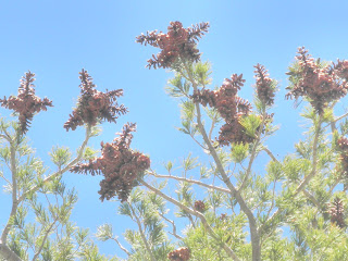
Below: Weird and wonderful star-like/angel-like pine cones, sitting at the top third of a tree near Granite Lake:


So--once we'd completed the hike to and from Granite Lake, we lightened our loads into the cars and then set out again, this time off to the left at the trailhead, toward Cascade Falls.

Below: Our first view of Cascade Falls, along the trail: they were bigger than I expected, and with the recent snow-melt after such a snowy winter, they were magnificent.


Below: the trail to Cascade Falls was mostly craggy, granite blocks and steps--similar to Echo Lakes type of terrain. Sometimes it was flattish granite slabs, however, as you can see below:


Below: A birds-eye view of Cascade Lake from the top of the falls. There's an impressive house far down on the lakeshore--we were hoping for a spontaneous BBQ invite, but no dice.


Below: Not a bad place for lunch--right at the side of the falls, in the alpine sunshine, listening to the sound of the water rushing down the mountain.


Below: A view of the side of Mount Tallac from the falls--we pass the Tallac trailhead driving to Bayview Campground.


Below: view of Freel (Peak (right) and Job's Sister (left) from the top of Cascade Falls: the group will be hiking to Freel later this summer--9 mile route on the right slope, 11 mile on the left slope. I think the group will be doing the 9 mile route.


At the top of the falls, we saw a web of multiple small feeder creeks, all going down, of course, to the falls, and beyond the creeks, we saw some intriguing open granite slabs, typical of Desolation Wilderness terrain. We, of course, wanted to explore further (and escape the crowds a little), and so we experimented with crossing the creeks until we found a log stable enough (already in the creek) to cross without too much peril.

Once over, we happily explored the granite slabs, resilient plants, the feeder creeks, tiny falls, and magnificent views. It's much less crowded once you make it over the creeks, and I felt as if I were in a National Geographic Special. The views continued to be amazing everywhere I looked.


Below: Crossing the creeks:


Below: Me on the granite slabs, once we'd crossed the creeks.
You can see the side of Mount Tallac in the background:


Stats:

Trailhead: Bayview Campground: 6880 feet elevation

Granite Lake: elev: 7670 feet.

  • 1 mile each way--dirt trail with few rock scrambling areas. Mostly shade
  • Relatively high use trail--expect to meet someone about every 10 mins.
  • Temps: low to mid 60's, but out of wind, warm. In wind at lake, chilly, but still sunny.


Cascade Falls: elev: 6550 feet
  • 1.75 mile each way--plenty o' rock scrambling, similar to Echo Lakes trail.
  • High use trail, but worth the crowds and, once there, you understand why people go there. Expect to meet someone every five minutes.


Total mileage: 5.5 miles
Elevation: between 6550 and 7670.
Drive from home: about 1 hour 44 mins

Both lake and falls are accessible via the Bayview Campground, opposite Inspiration Point Trailhead, just past Emerald Bay Campground on SR 89 North and past the Mount Tallac trailhead and Fallen Leaf campground.

To get to the trailhead, park at the back of the Bayview Campground, but arrive before ten to get a space. Other spaces are available on the side of the road, but it's a very popular area, so get there early (ie before 9:30 or 10am) on weekends or go on a weekday to avoid crowds and get a safe space.

The trail beyond Granite Lake seemed really snow-bound still. Future hikes include the Velma lakes and possible Eagle Falls (although those falls look incredibly crowded).

This hike was a mixture of Trail #28 and 29 in Top Trails Tahoe.

All in all, a stunner of a hike. Well worth the trip. It's not a long hike, but I felt pretty worked out at the end of it, and because it wasn't a huge number of miles (only about five), I got home at a decent time--with enough hours in the day left to write this blog entry. :)

Friday, November 13, 2009

Ralston Peak hike Nov 8 09


See the tiny people on the top of Ralston Peak above? That's my group, and that's where I had lunch. :) We didn't climb up the sheer rock wall; instead, we hiked up the ridge, which was exciting enough, thankyouverymuch.

Weather: beautiful; sunny, chilly, but amazingly great for November in the Sierras. Probably around 50s for start; once you get hiking, for the first half, you're in the forest, and consequently sheltered, so t-shirts and light pants are fine. In the second half of the hike, when you're on the exposed part of the hill, you're grateful for windproof pants/jacket/hat/gloves. It felt about 45 at that point, albeit a sunny cool and windy day on the peak.


Company: On this hike, I was grateful for company--my intrepid friend, Maria, came with me---and so she and I travelled solo up 50 to the Ralston Peak trailhead wherein we met up with the hiking group. There were maybe about 15 or so people on this hike, and as usual, we started out in a big long line of hikers but gradually, each found our place and speed and settled into the hike.

Stats re hike: Ralston Peak trailhead--directly opposite the 50 exit to Camp Sacramento. A little tricky to get to because it's right on a corner, but plenty of parking, so no problem there. Hike was about 7.5 miles or so. We hiked the longer, not so steep way, in order to see the Lake Aloha overlook, but if you go the more direct route up to the peak, it's about .5 mile shorter (but much steeper). We hiked for about 2.5 hours up and then maybe 2 hours down? We didn't keep tight watch of the time for this hike.

Out and Back hike: Elevation gain: 2,735ft (from 6,500 - 9,235ft)

Below: the hike starts out in a series of switchbacks, ascending through the lower forest:


Below: Periodically, you pop out into a clearing with magnificent view of the surrounding areas, including the unfortunately snow-free slopes of Sierra at Tahoe (which you can see in the pic below):
Below: after a mile or so, you enter the Desolation Wilderness area. We were with a group who already had permits, but there were no permits that I saw available (or even a place to sign up for them) at the trailhead. I'm not sure where you're supposed to get them from unless you want to go to Echo Lakes or another trailhead.


Below: The trail varied in terrain, but in the lower parts of the hike, the trail was hard packed dirt (easy to hike on):


Trail Notes: Once you get to the bottom of the peak, you can choose between two routes to the peak; a use trail, marked by cairns (piles of rock) that leads straight and steeply up the peak. That's about half a mile shorter than the other trail option, which leads off to the left.

The left trail, really the continuation of the main trail, is less steep but also about a half mile longer than the steep use trail. The long trail, however, also contains this stunning view of the Lake Aloha area, which was fun to see since I did that hike not too long ago.


Below: About three miles into the hike, once you're through the forest and out onto the slopes of Ralston Peak, you come across the overlook to Lake Aloha and Lake of the Woods and some amazing Desolation Wilderness scenery.


In the pics above, you can see Pyramid Peak (off on the left), followed by Dicks Peak, and then, I don't think you can see it really, off on the far right, is Mount Tallus--a goal of mine for spring 10.


Below: A piece of wood demonstrating exactly the harsh effects of a life at over 9000 feet:


Almost directly opposite the Lake Aloha overlook is the use trail (ie unofficial trail), marked by cairns (or clearly people-made balanced piles of rocks) indicating the way up to the peak. Keep an eye out for the cairns, which are placed strategically along the way; they can help you keep going toward the peak.

Below: On the way up to the peak; you can see that we have to hike/clambor over several hundred feet of loose tallus, precariously balanced pieces of granite, sheered off rock faces over the years. It was tricky but worth the hike to get to the peak.


The view from the peak was stunning; you could see 360 degrees from Echo Lake to Lake Aloha (past Mt Tallus), all the way round to Sierra at Tahoe with whole number of peaks with which I'm unfamiliar. Stunning views and a great place to have lunch.


Below: I think this is a pic of Lake Aloha from Ralston Peak :


Below: Echo Lakes (upper and lower) from Ralston Peak:


Below: After lunch, a small group, including Maria and I, hiked off to the east to find some little lakes called "Cup Lake" and "Saucer Lake." First, though, we had to survive this tallus field:


Below: We missed Saucer Lake because we'd moved off the tallus field onto the more hiker-friendly meadowland, but we did see Cup Lake--an amazing little patch of water completely hidden from view inside a very steep 'cup' of granite. Worth the additional little hike to see it.


Gear Notes: I definitely needed windblocker gear for this hike; while it was calm and warmish in the lower forest hike, once out onto the slopes of the peak, the weather, while still sunny, was quite a bit cooler and windier; windblocker pants (REI Mistral) and softshell jacket (REI Mistral again) both proved their worth today as did a windblocker hat and gloves. I was very glad I had bought/worn them along.

Below: Finally, the forest on the way back down again; a beautiful hike, with great company, on an amazing weather day for November up at the hill.


Below: Ralston Peak from Google Earth: you can see Cup Lake at the bottom right, Echo Lakes at the top right/middle and possibly Triangle Lake above the Echo Lakes.


Learn more about Ralston Peak: http://www.trailspotting.com/2007/12/mt-ralston-peak.html

Friday, October 23, 2009

Echo Lakes to Tamarack Lake


I couldn't resist another trip to Echo Lakes on my day off from work today. The Desolation Wilderness experience has been calling me for a few weeks, and the planets aligned enough for me to take off and go outside for the day.

Weather: perfect--sunny, little wind, low-60s warming up to mid-60's--t-shirt weather and wonderful. As you can see above, the lake was mirror-lake when I arrived. Beautiful sight.

Stats:
  • Two hours drive up the hill along 50 to Echo Lakes.
  • Echo Lakes to Tamarak Lake is about 3.8 miles each way out and back. Total mileage today 7.6 miles.
  • Time (including taking pictures and enjoying the view): 3.5 hours. I hiked from 10:55-2:30. Remember that time includes pix and scenery admiration.

It was a weekday hike, and I had wondered how the trails would be in terms of company. There was a steady stream of people on the trail, and I felt completely safe--I passed a hiker/backpacker pair or so about every 30 mins, which was perfect. I felt 'away' but not isolated--the perfect type of feeling and great for escaping the rigors of work for a while.

Below: Here are some pics of the trail; as you can see, the trail varies from hard-packed dirt/rock to clamboring over moderate rocks to uneven large scree. It's always interesting, but it's also a good place to wear some ankle-supporting boots. You can hike at normal speed for half the hike; you're at slower speeds for the uneven sections, of which there are plenty, which makes for an interesting hike.


The trail and rocks were mostly dry, despite the recent storm, but there were tiny streams of water crossing the trail here and there, which made the trail satisfyingly crunchy in a new way.

Gear Comments: Plus, not so fun as the crunchy trail, I discovered that my boots are not that sticky on wet slick granite. Perhaps no boots are that sticky on that type of rock, but I slipped twice, saved from a painful tailbone incident only by my hiking poles. I'll have to remember to tread carefully when it gets to slippery hiking season. Thank goodness for poles!

Also, I've discovered that I'm not yet that used to my larger sized feet (in boots a size larger than normal because that's how hiking boots are). With the additional 1/2 inch in length, I haven't yet learned to pick my feet up in ways to accomodate the extra length, so there was an inordinate amount of tripping here and there. Again, I was grateful for the additional stability of hiking poles. Other than that, the boots are great. The additional length is just something I have to learn, I think.

Final Gear Comment: I'm probably the last person in the hiking world to have discovered Luna Bars, but so be it. Suffice to say that the banana nut bar can carry me through an entire 7 mile hike. Not bad and definitely tasty.

Below: The trail offers you some marvelous views of Upper and Lower Echo Lake on your way to Tamarack Lake.


Below: not a bad view for lunch! I sat on the bench on the boat taxi pier and watched the lake for a while. Pretty amazing that it's real, that it's not a screen-saver, that I live near enough to come places like this fairly regularly:


Disclaimer
: I didn't actually find Tamarack Lake; there's a sign but no trail among some rock-scrambling. Since I was solo, although navigation was simple, I didn't want to venture too far off trail to find Tamarack because I wasn't too sure exactly where it was and whenever I looked back to find the trail, it turns out that all the rocks and trees look essentially the same off trail. I'll have to explore that part next time I'm up. No worries.

Below: Google Earth view of Lower Echo Lake; the trail goes around the top of the lake and then continues Northwest from here.


Mileage Stats from Echo Lakes Trailhead: http://www.fs.fed.us/r5/ltbmu/recreation/wilderness/desowild/trails/east/echo-lake-trail.shtml

Saturday, October 3, 2009

Castle Peak, Donner Pass CA

I recently went up to Castle Peak, over by Donner Pass, up at Tahoe. (Does that last sentence have enough prepositional phrases for you? :)) It was a beautiful hike with the hiking group again, and this time, it was a more relaxed pace, which was good.

Weather: Stunning--mid-high 70s to low 80s most of the day; we hiked from 9:30 to about 2 or so. No wind or clouds; just a beautiful day.

Hike: about 5 miles each way, with some significant elevation gain in the last few miles. A great trail, however--well signed. A safe single hiker trail--plenty (but not too many) of people around, it seemed. Steep in places with a little bit of tiny bouldering here and there--clamboring really. Avoid the cut offs for the switchbacks to avoid furthering erosion.

Below:We started out at Castle Peak Trailhead, and we wandered up a floury-dusty fire road, on the PCT. The dust came over your boots in places, but the path also crossed two teeny tiny creeks, determinedly chuckling over the trail:


Below:This dusty path, crossing those two tiny streams,gradually ascended and transformed into hard-packed dirt:


Below: The trail then finally metamorphosed into an even more rocky path at this point: Castle Pass junction where you can go straight across, continuing on the PCT (and to the Peter Grubb Hut---which I'm dying to see). Or you can go left and explore another trail. Or go right, as we did, and leave the PCT as we joined the Castle Peak trail up, up, and away up toward the peak:


Below: We could see the three turretted peaks of Castle Peak getting closer as we ascended the Castle Peak Trail:


Below: Looking up the trail as we left the PCT/Castle Pass junction, we could see this view:


Below: We had some pretty steep and rocky trails along the way, but it was well-signed, and the path was evident from top to bottom:


Below: The peak kept getting closer and closer and became the more impressive the closer it became:


Below: More pix of the trail as we wound our way up:


Below: You can get an idea of how steep parts of the trail was:


Below: Someone had made a cairn/shelter of sorts underneath an overhang under the first turret; it would have offered some shelter from wind perhaps, had it been a different type of weather day:

Below: Finally, we see this wonderful view from the top of the middle turret:


Below: And not a bad spot for lunch:


Below: My faithful poles enjoying the rest and the view:

Plans for future hikes in this area:

  • combine this hike with a hike to nearby Baisin Peak for around 14 miles or so; I heard the trail from Baisin Peak back to Peter Grubb is a little hard to follow, so perhaps do an out and back to Baisin from Castle?
  • at Castle Pass trail junction, go to Peter Grubb Hut and beyond to explore the PCT further.
  • Highly recommended vigorous (but not killer) hike. Pretty high altitude--over 10K, so be prepared for that. Layers as always to accommodate wacky mountain weather.

Gear Comment: hiking poles are strongly recommended for stability and help in climbing: I would have had a hard time without mine on this hike.

Boots: This was my first hike in my new Merrill boots; they performed splendidly although I'll need to get one size bigger to protect by toenails on the downhill. I'll be surprised if I don't lose at least one the way my toes were banging up against the toe of the boot. Other than that, the boots were so comfortable and so grippy and so great, I completely forgot I had them on. Not bad for a hike straight out of the box. I took my Salomon in my backpack, but I didn't need them at all. Cool.