Showing posts with label waterfalls. Show all posts

Saturday, June 11, 2011

Pioneer Trail, Emigrant Gap

Above: the snow melt from this winter's huge snow fall is evident in this picture of the massive waterfall, two miles into the hike. Amazing to see, particularly at this time of year..

We had a great time up near Grouse Ridge and Nevada City today, hiking the Pioneer Trail, a trail my son had found near Lake Spaulding. Our hike was a family affair this time out--my two sons and our dog accompanied me on the hike, and it was a fun day.

The trail starts out at a smallish trailhead, just over South Yuba River Bridge. The trail sign is merely a sticker on a metal post, but the trailhead itself is evident, so you should have no problem identifying it as your destination.


Below:Lighten your daypack: don't bring your gold prospecting tools; this area's been claimed already.


The trailhead itself sits at the side of the South Yuba River, which is a river I now regard with new respect; the recent snow melt has resulted in a impressive flow of roiling water, careening along, and as soon as you emerge from your car, all you hear is a roar of the water on its way down the hill.


The trail itself is a pretty easy trail as far as things can go. The surface is well maintained, with few dramatic elevation gains, and it follows along the side of the river for most of the time. The entire trail is 25 miles long, but since we were having a family hike and not a forced march, we limited the mileage to five miles total, which took us past this disturbing sign:


We eventually figured out that the water 'discharge' would not come from above us at a random place or interval, but rather from this impressive waterfall, two miles into the hike:


The waterfall, while human controlled via a dam at the top, was very impressive, with thousands of gallons churning down the hill into the river. We had no idea it was there, so it was a huge surprise and it made for a perfect lunch spot for us all. We gazed in wonder at the aquatic power in front of us.

The scarey sign, therefore, seemed rather to be warning people to stay off the boulders at the river's edge (about 30 feet below us) rather than warning people to stay off the trail itself.

Below: The deluge of snow melt had overflowed the river banks, as you can see from the picture below. The trail, however, was about 30 feet above the banks, so as long as you stayed away from the edge, you were fine.


The trail was mostly a single track in good shape and with a variety of surfaces--mostly loam but also with frequent granite chips.


Here and there, the trail had metamorphosed into a stream bed, and, because of the wet winter and recent snows, the creeks crossing the trail required some rock hopping here and there, but nothing too hard. Hiking poles can help balance you in those river crossing situations.

We walked mainly through forest, but we regularly had spectacular views of the river, churning below us, and periodically, we'd find ourselves walking through a spectacular foot hill meadow, walking past a verdant pasture, surrounded by a circle of pines.


As I walked along with my family and our dog, I was astounded at how lucky I am to be able to do this. My two wonderful sons were having a great time, enjoying outside activity in a wondrous natural environment. We are all healthy enough to hike, and we all enjoy hiking as a way to spend the day. We have the resources to get ourselves there and to enjoy it all. We live close enough for day hikes in this wonderful resource to be possible. Finally, we were fortunate to have perfect hiking weather.

We truly are amazingly fortunate. Hope you get the chance to explore the trail too.

Trail stats:


  • Trail info: The Pioneer Trail, built in a series of volunteer efforts from the 1980's to the mid 1990's, is 25 miles long one way. There are several trailheads along the way, however. We joined at the Lang Crossing trailhead, of CA 20, on the Emigrant Gap exit on 80.


  • Driving: Easy--just up 80--Emigrant Gap/CA 20 exit (#161). Drive right on CA 20; look for Bowman Lakes Road. Trailhead is a few minutes past the Lake Spaulding sign. About 90 mins from home.


  • Trail: mixture of duff, dirt, loam, and granite stones/rocks.


  • Parking lot is small--can fit about 6 cars, but not that heavily used, so should be ok. No facilities.


  • Weather: beautiful--70s, sunshine, breezy. No snow at 5000 feet in early June, which surprised me considering we're in a record snow year.

  • Traffic on trail: very little. We passed one other person--a trailrunner and her two dogs. We saw two other hikers at the trailhead, but didn't see them again.

Want to learn more:


https://legacy.losrios.edu/owa/redir.aspx?C=1fb656c5673e4ef5a7f7b61531d770b3&URL=http%3a%2f%2fwww.goldcountrytrailscouncil.org%2fPioneer_Trail.pdf

Monday, April 4, 2011

Stevens Trail, Colfax CA April 2011 II


Above: Wonderful view through the flowers to the North Fork of the American River, from the Stevens Trail. (Thanks, Maria, for the pic!)


After a few weeks of colds, flu, and vertigo, Maria and I finally made it out the foothills today. We were originally going to walk the Euchre Bar trail, but we discovered it was still under 18 inches of snow/ Instead, we drove back down the hill for 30 mins, and happily settled on walking the famous Stevens Trail near Colfax--an old, popular, and well maintained trail which offers tremendous views of (and ultimately access to) the North Fork of the American River. It's a great trail, and only about 70 miles drive for us from Sacramento, which makes it even better. :)


The weather was perfect--mid-60's to low-70's, a little breeze when you needed it, and plenty of sunshine.


Above: Welcome to the Stevens Trail trailhead.

The trailhead is large and overtly signed, but note that the 60 Hikes within 60 Miles of Sacramento book has a small but important error in the location of said location; it's on Canyon WAY and not Canyon Court (FYI).


The parking lot can fit probably 20 or so cars, with plenty of overflow parking on the street. Pay attention to the parking signs if you use the overflow parking, however. You may only park on the north side, I think, and it would be a bummer to get a ticket after a great hike.


The trail used to be a toll footpath between 1871 and 1906, and it took walkers between Colfax and Iowa Hill. It's a rare type of trail because, although it takes hikers down 1200 feet to the river's edge, it doesn't use any switchbacks. Instead it uses "gentle engineering" which results in a modest slope for the entire trail. A great break for the knees. :)

Above:Here, I'm standing on the table rocks just before the (rather precipitous) waterfall on the Stevens Trail.

Trail type varies, but is mostly dirt and rocks, with some shale slopes mixed in. There are some shady parts, but it's exposed for the most part, so take some block. It's a well maintained, well signed, and well traveled trail. Slopes are about 6% average, with 40% max, but it's really a fairly moderate hike, overall, in terms of difficulty.

Below: here are some pics of the shale part of the trail. Just above this shale slope is a yellow brick wall, built by the Chinese laborers back in the early Gold Rush, to retain the railway track that runs (or used to run?) above the river.


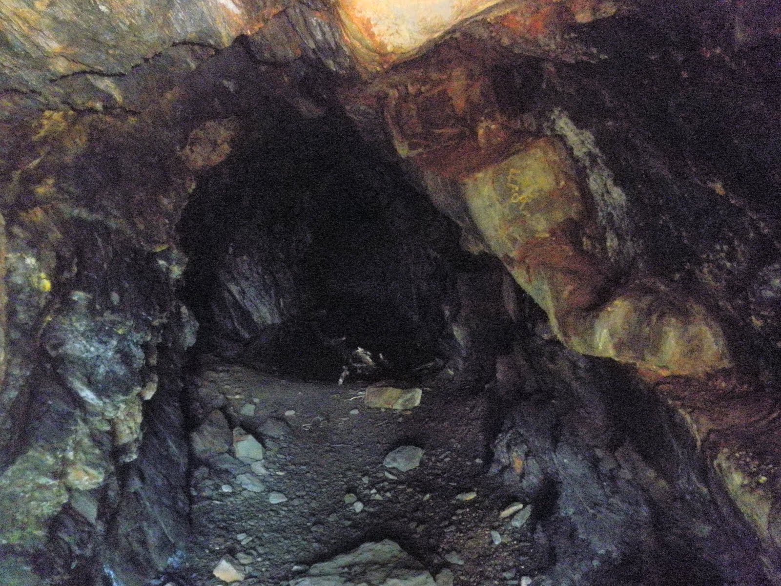
Below: Along the way, you pass an old gold miner's cave. It seems to go back a long way, but it's likely dangerous to explore too far in.


Below: On the way down the trail, and it's mostly down on the way out, but it's a fairly subtle slope for the most part, you can see the river down below:


Below: And here again--a high view of the river, this time with some beautiful lupins--flowers are abundant at this time of year:


Below: this is the bottom of a largish waterfall, the falls larger than normal because of the recent rains. It's about 30 mins from the beginning of the trail, and you have to cross it to continue the hike.

See that small shiny (wet, slippery, treacherous) rock in the middle of the water? That's your stepping stone to the other side. You can also see on the right the rather precipitous fall down the hill and how there really isn't too much margin for error. Additionally, in the middle top of the pic, you can see the tricky sharp, pointy, wet landing rock. :)

It's not normally, I understand, this submerged, but since it can be, just take your time crossing.


Below: Once you survive the waterfall crossing, you walk down further along the trail, and you are rewarded with this view for a lunch time breather.


Below: with all the rains recently, even the small feeder creeks are running strongly, as they rush down to replenish the American River.


Trail Stats:


  • The trailhead sign notes that it's 4.5 miles each way--9 miles total


  • Dirt and rocks for trail surface. About 1200 feet elevation loss along the trail.


  • Well maintained and signed overall; one early fork where you needed to keep to the left and go over a small hill to find the trail.


  • About four hours, including lunch and pic pauses.


  • Popular trail--good for solo hikers.


  • About 70 mins past Sacramento-an easy drive.
Want to learn more?
Link to Auburn State Recreational Area


Sunday, May 9, 2010

Alamere Falls, Point Reyes National Seashore, May 9 2010

Maria and I went for a Mother's Day hike today to Alamere Falls in Point Reyes, and what a wonderful hike it turned out to be. This view above, typical of the views on a sunny May day in Point Reyes, shows the wildflowers, out in force, on the approach to Wildcat Beach.

A stunning, stunning, stunning day.

Our chosen route: Palomarin Trailhead--Coast Trail--Ocean Lake Trail--Wildcat Camp--Wildcat Beach to the falls.


You can get a choice of maps from from Bear Valley Visitor Center; I would get the free black and white map on big paper. It has mileage and very clear trail indicators. Check also the tide timetable at Bear Valley Visitor Center or online. You'll want to walk along Wildcat Beach for a mile if you want to get to the bottom of the falls without going through poison ivy.

Below: the Palomarin Trailhead sign; the trail has lots of signs indicating direction; with several options to get to Alamere Falls, it's worth reviewing a trail map to help you plan your route.


Below: the early part of the trail is on hard packed dirt, but later parts vary from angular granite, to loam, to sand. The trail has plenty of poison ivy and stinging nettles, but they're off to the side of the trail, so they're easy to avoid.


Below: my first banana slug. Apparently, you're supposed to put the slug on your hand and lick it. Since I'm not a UC Santa Cruz alum, I didn't have to do that. :) The slug is next to Maria's new hiking shoes for size comparison.


Below: an early indicator of direction for Wildcat Campground--an area with beach access to Alamere Falls.


Below: getting closer!


Below: one of four wooden bridges on this hike--lots of creek crossings but all with bridges, so no wet feet.

Below: One of two largish lakes you pass on the Ocean Lakes Loop Trail. This one below is Pelican Lake on the way to Wildcat Beach.


Below: first glimpse of Wildcat Beach from the Coast Trail.


Below: Looking North at a foggy view of Arch Rock, north of Wildcat Beach. The fog, while present at the higher hills, didn't touch our hike at all; instead, if you looked to the left (south), our direction of travel, we had light wispy clouds and a bright blue sky.


Below: our view for lunch; we sat on camping logs and enjoyed couscous (thanks, Maria!), hummus, and drinks. A wonderful place for lunch with great company in a stunningly beautiful locale. People travel from all over the world to this park. We're blessed to be able to visit it so easily.

Below: Maria and I were thrilled with the walk along Wildcat beach toward the falls; the sunshine, the warm temps, the stunning scenery, the deserted beach; we decided that there was nothing better for this wonderful day.


Below: the view toward Alamere Falls; the beach was steaming because the air was so warm.


Below: Approaching Alamere Falls--they're already looking cool and impressive, even from a distance.


Below: 'skull' rock--an interesting rock on the beach with holes bored into it from sea/stone action over time.


Below: the bottom of the falls, where the fresh water meets the sea on Wildcat Beach.


Below: here I am, enjoying the view of Alamere Falls. Lots of water sounds--the crash of the ocean waves mixed with the constant roar of the waterfalls, leading to a very enjoyable snacking area. :)

In this pic below too, you can also see my Bledsoe brace, for which I am supremely grateful and without which I wouldn't be able to complete my hikes. It's my exo-skeleton--custom-made, very comfortable, and essential for my knee.


Below: On the way back to Wildcat Camp, a view toward Arch Rock.


Below: more Arch Rock views from Wildcat Beach; the clouds, while threatening, dissipated rapidly, leaving only sunshine and blue skies.


Below: field of wildflowers (wild mustard) at Wildcat Camp.


Below: more wild mustard fields, including cow parsley--a blast from the past for me. Just behind me, later on the hike, we saw a fawn, taking gigantic yet inefficient mostly vertical leaps to get away from us. Gangly legs and curious eyes-enchanting little guy.


Below: one of a series of unending amazing views on this hike. This view, on the way back, is looking north toward Arch Rock.


Below: the trail on the way back, looking toward Palomarin Beach, the access to which is 0.6 miles from the Palomarin Trailhead.


Stats:
  • Weather: prediction was awful--thunder storms, 54 degrees. Reality was wonderful--layers, of course, since it's Point Reyes, but at least some of the day was in t-shirts with block on. The rest of the day was a long sleeve fleece with sometimes a fleece vest. No rain although it dumped in Novato about an hour earlier.
    Trail: mix of loam, sharp granite, loam, wet mud, and sand. Faily steep in places and most often up and down. Not much flat, so be prepared.
Mileage:


  • Palomarin Trailhead: 0

  • Coast Trail: 4.2

  • Ocean Lake Loop: 1.3
  • Wildcat Beach: 1
Return:
  • Wildcat Beach: 1
  • Coast: 5.5
  • Palomarin Trailhead: 0
Total: 13 miles
Time: 6 or so hours, including an hour or so for taking pix, enjoying the views, eating lunch, and sitting by the falls. Plenty of up and down, but nothing huge. Not flat, though, so be aware of that.

More info? http://www.nps.gov/pore/planyourvisit/index.htm

Wednesday, February 10, 2010

Sugar Loaf Ridge State Park: Bald Mountain/Vista Trails


This time last week, I, for one, still had no idea that Sonoma/Sugar Loaf Ridge has such beautiful views. Now, blogging this hike a few days later, I know that that area is well worth visiting with really enjoyable and stunning foothill type of hikes--it's a winner of a hiking spot and now one of my favorite low-elevation areas.

So--the original plan was to meet up with my usual hiking group and hike up Hood Mountain, but, due to some confusion on our end, I and a few others from my original group ended up walking with a different hiking group, this one from the North Bay. Very friendly people willing to adopt some errant hikers from another group, so I appreciated their company.

After some confusion as to who was in what group and where the hike was going to go, we ended up walking up Stern Trail on our way to Bald Mountain. This trail is pretty direct (good), but it's also paved the entire way (less good). While the company was interesting, therefore, the paved trail was a little disappointing.

I learned that I don't much enjoy walking on paved trails although this one had some pretty redeeming views:
Still, paved roads,for me, lack the feeling of exploration or escape that seem to come inherently with a hard packed dirt or loam single track trail. I hadn't been to Bald Mountain before, however, and it was rumored to have wonderful 360 views of the Napa countryside, so I decided to go check it out with the newly adopted group.


As we marched up toward our destination, I noted that there were numerous trail offshoots along the way, so I knew that, on the way down, I would do some 'sploring of the other (non-paved) trails.

Once at the top, the view from the top of Bald Mountain was, indeed, worth it. You could see all the way to Point Reyes in one direction to the SF city in another to Mount St Helene in another to Pyramid Peak (in the Sierras) in yet another direction--all four compass directions had wonderful views--quite stunning. It was also a very clear day, so you could see as far as your eyes would allow you to do so. Plus there were very helpful signs to help you identify the peaks around, and overall, it was definitely worth the hike up.


The question for me, of course, would be the most scenic and enjoyable way to go down from this vista-rich peak. The map showed several possibilities that reduced significantly the amount of time spent on the paved road, so I determined to explore the options on the way down.

After studying the (really helpful) State Park map (available for $1 from the Visitor Center/park ranger), I decided to explore the Vista Trail. Any trail named 'Vista' is probably worth exploring since park officials tend to keep that name for the most beautiful trails.


So, about 1.2 miles down the Bald Mountain Trail/road, I side-tracked down Vista. By the way, on the way down Bald Mountain Trail and all along Vista, I kept hearing an ominous buzzing of bees, and, after looking around to see what was up, I realized that the trees on the side of the trail were all in bloom, and that they were consequently just dripping with bees. It seemed early in the year for the bee/bloom thing to be happening, but it was neat to see that at least those types of bees were thriving.

As soon as I stepped onto Vista, I felt myself relaxing as I realized that now I was doing what I had come to do. Vista was a single-track hard-dirt, loam trail, surrounded by trees, bushes, streams, and creeks, and nary a paved road in sight. There were tiny bridges, interesting creek crossings, lots of winding trails close to woody and leading meadowy/big sky areas---yes, this was what I had come to experience, and now, thankfully, I was. I was so happy; it was perfect, and while a day hiking is never awful, of course, Vista truly made the day fit more closely my expectations and hopes.

Vista is a pretty great collection of trail types. You walk through mossy, damp, wooded tree areas to various open meadow and hillside/big sky type of trails, and, as with all trails, you're just never sure what is coming up around the corner. It was wonderful. Since it's been so wet recently, it was a pretty muddy trail, but my Keen shoes are great for that type of hiking, so I was happy as a clam as I sloshed and squelched along the trail.


Half way along Vista, I discovered the name-sake area for the trail-- a huge rock upon which you could sit and just enjoy the view of several large rolling hills straight in front of you. It was a peaceful pondering place. Below you lies a vast expanse of downhill meadow, and you could sit there and just enjoy the day. Well worth leaving the paved trail for this experience.


Because it's been so damp recently and because my other group had planned to hike Goodspeed Trail and because that trail had been thought to have a creek crossing, I had my Teva sandals with me along with a tiny camp towel because we thought we'd need to do some paddling across the trail.

Why do I mention this tiny gear-fact? Because at the end of Vista, there turned out to be a relatively small but determined creek lying directly across the trail--possibly about 6 feet wide and maybe five inches deep.


Hmm--too deep for Keens, but perfect for my Tevas. :) I hadn't done a creek crossing before, and while I realized it was in no way dangerous, it was kind of fun to do. I changed shoes, repacked my bag, and ventured across the creek. The water was invigorating and my feet were refreshed, and the whole thing was quite the adventure for this new hiker. I was happy to have the right gear to be able to do so.


After the creek crossing, the trail opened up a little into more meadowy surrounds, and I joined the Hillside Trail, which looked more like this:


Hillside was quite steep in places, but always pretty, with plenty of hills, meadows, trees, and even deer to see as you walked along the trail. I couldn't believe that we hadn't hiked up that way to begin with, but ce'st la vie. It was a very pleasant people walk up the hill, after all.

Once I returned to the car (via Hillside and then along the Creekside Nature Trail--very sweet with a bridge, it turns out, built by a colleague when he was an Eagle Scout way back when), I wanted to explore one more trail. I had heard about a terrific waterfall in the area, and since it had been raining so much, I thought now would be a terrific time to find it.

I walked out of the park, down the road for about 200 yards, and then turned left and went down, down, down on the Canyon Trail-- a short steep, stepped trail, about 0.6 miles each way, down to the waterfall.

It was a pretty, primeval, damp forest, with plenty of moss-covered trees, sticky trails, and no sounds.


After about 0.5 miles, I found myself at one smaller waterfall (or really a series of stepped waters because the water didn't really fall so much as work its way down a series of rocks). It was pretty enough to almost convince me to stop there, partly because it was getting a little late and party because I could tell that the going up hike would be pretty rough on my knees; still--I wanted to see the big waterfall about which I had heard so much, and since I was mostly there, I decided to keep going toward the larger roar of water, and I was very glad I did.

Pictures can't do the waterfall justice, of course, but it was pretty stunning, no? Lots of mossy rocks, the huge wall of roaring sound coming from the falls and about 20 feet or so of rushing water. I was the only one there at the time, so as a bonus, it felt like my own personal falls and truly, it was a great end to my invigorating day.

Stats:
  • mid-50's, cloudy/sunny/dry

  • $8 to enter park--worth it since the parks are feeling the economic pinch too. Many park in the small turnouts along the way, but since I was using the park, I thought I should probably pay that pittance to do so. Plus, before you believe that I'm being too righteous for words, I have to note that also there were no available parking spots outside the park. :)

  • pay $1 to get the trail map; the trails themselve are well signed, but the overall trail map sign at the trail head is faded and hard to read. The map came in very handy once I discovered I wanted to change the trails. I learned also that it's well worth studying the map before you go up a trail; if I had studied it more closely, I could have seen even before the hike started that that trail was going to be paved.

  • about 1.5 hours from home

Trails:

Going Up:
Stern Trail (paved): 0.35

Bald Mountain Trail (paved): 3.4 one way

Going Down:
Bald Mountain Trail (paved): 1.2

Vista Trail (dirt with creek crossing): 3.2

Hillside Trail (dirt): 0.75

Side Trip:

Canyon Trail (dirt, steep trail steps) to waterfall: 0.6 x 2 =1.2

plus lots of wandering: 1.5

Total: 11.25 miles