
Wow. What a stunner today's hike was. It was one of those "hard to believe we were there" type of hikes. Off we went, then, to Granite Lake and Cascade Falls--an easy and beautiful combined hike to do on such a beautiful, early summer alpine day.
Below: our choice in trails at the trailhead.

A note about permits: "Desolation" (on the sign above) stands for, of course, "Desolation Wilderness." You'll need a Desolation permit to go to Granite Lake; you don't need a permit for the Cascade Falls hike (because it leaves Desolation Wilderness).
The permits are usually available at the trailhead, and 12 people can go under any one day permit; if you want to backpack or stay out longer than a day, you need to go to the Ranger Station at Pollock Pines or Mill Run to get your permit there.
I went to the Ranger Station on the way to the hike and picked up a few spare permits for the hikes when you need a permit, but there are none at the trailhead. I also found some great Desolation Wilderness maps which should come in handy on future hikes. It's fun to discover exactly where you are on the map and then be able to identify, with some certainty, the peaks surrounding your position. That way, you can also have a good idea of your elevation too. All good data to have, I think.
We went to Granite Lake first; we'd heard it was the harder trail, but it really wasn't. It was a good starter for the day--dirt trail with a few rock scrambles here and there. A relatively easy warm up, and although its length is not intimidating, if you add in early exposure to altitude and an unpredictable knee, it was a decent workout, after all.
This trail was not very crowded--we saw perhaps two or three other groups along the trail total--despite the huge crowds around the area. This place is a great secret to have. :)
This trail is not a flat trail; expect a steady periodically steep elevation gain which, combined with some altitude of 6600-7800 or so, can make for a decent workout.
Below: Trudging up the Granite Lake trail: you can see it's fairly steep in places.

Granite Lake was worth the hike and elevation gain, however. First, we had some stunning views of Emerald Bay itself.
Below: Here I am at one of the views over Emerald Bay.

Below: the slope you see on the left of the pic below, beyond the bay, is the lower elevations of Jake's Peak:

And then we had the beauty of the Granite Lake itself--pretty much deserted, despite its proximity to Emerald Bay, one of the most popular places in California.
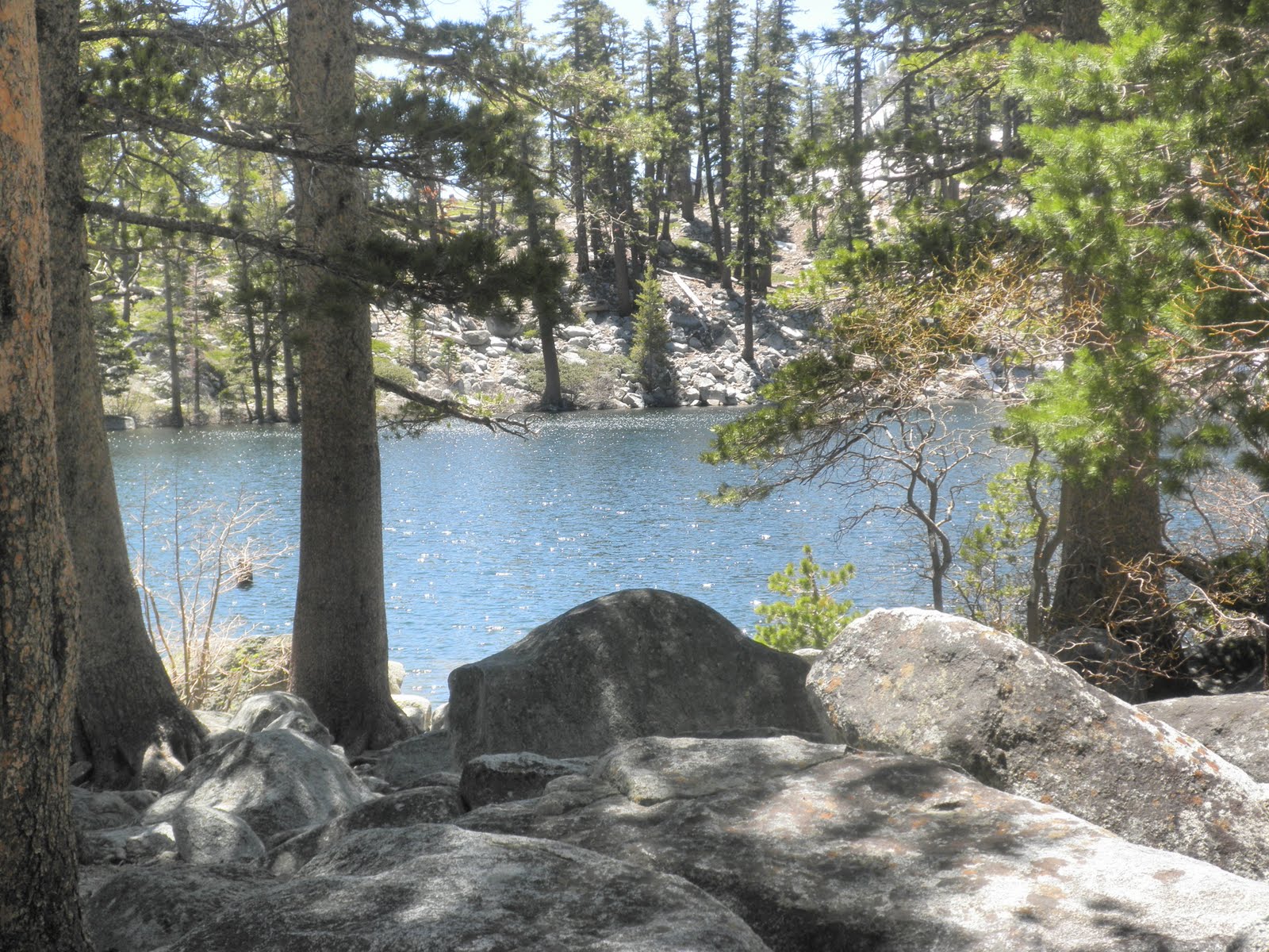
Below: a view of Granite Lake through the trees. . A few patches of snow here and there, but for the most part, the snow remains only at around 7800+ feet, and even then, mostly in patches, depending on sun exposure of the slope.
Below: A picture of the hiking group at Granite Lake--a great bunch of friendly, fun folks. I was happy to hike with them.

Below: Weird and wonderful star-like/angel-like pine cones, sitting at the top third of a tree near Granite Lake:

So--once we'd completed the hike to and from Granite Lake, we lightened our loads into the cars and then set out again, this time off to the left at the trailhead, toward Cascade Falls.
Below: Our first view of Cascade Falls, along the trail: they were bigger than I expected, and with the recent snow-melt after such a snowy winter, they were magnificent.

Below: the trail to Cascade Falls was mostly craggy, granite blocks and steps--similar to Echo Lakes type of terrain. Sometimes it was flattish granite slabs, however, as you can see below:


Below: A birds-eye view of Cascade Lake from the top of the falls. There's an impressive house far down on the lakeshore--we were hoping for a spontaneous BBQ invite, but no dice.

Below: Not a bad place for lunch--right at the side of the falls, in the alpine sunshine, listening to the sound of the water rushing down the mountain.

Below: A view of the side of Mount Tallac from the falls--we pass the Tallac trailhead driving to Bayview Campground.
Below: view of Freel (Peak (right) and Job's Sister (left) from the top of Cascade Falls: the group will be hiking to Freel later this summer--9 mile route on the right slope, 11 mile on the left slope. I think the group will be doing the 9 mile route.

At the top of the falls, we saw a web of multiple small feeder creeks, all going down, of course, to the falls, and beyond the creeks, we saw some intriguing open granite slabs, typical of Desolation Wilderness terrain. We, of course, wanted to explore further (and escape the crowds a little), and so we experimented with crossing the creeks until we found a log stable enough (already in the creek) to cross without too much peril.
Once over, we happily explored the granite slabs, resilient plants, the feeder creeks, tiny falls, and magnificent views. It's much less crowded once you make it over the creeks, and I felt as if I were in a National Geographic Special. The views continued to be amazing everywhere I looked.
Below: Crossing the creeks:

Below: Me on the granite slabs, once we'd crossed the creeks. You can see the side of Mount Tallac in the background:

Stats:
Trailhead: Bayview Campground: 6880 feet elevation
Granite Lake: elev: 7670 feet.
- 1 mile each way--dirt trail with few rock scrambling areas. Mostly shade
- Relatively high use trail--expect to meet someone about every 10 mins.
- Temps: low to mid 60's, but out of wind, warm. In wind at lake, chilly, but still sunny.
Cascade Falls: elev: 6550 feet
- 1.75 mile each way--plenty o' rock scrambling, similar to Echo Lakes trail.
- High use trail, but worth the crowds and, once there, you understand why people go there. Expect to meet someone every five minutes.
Total mileage: 5.5 miles
Elevation: between 6550 and 7670.
Drive from home: about 1 hour 44 mins
Both lake and falls are accessible via the Bayview Campground, opposite Inspiration Point Trailhead, just past Emerald Bay Campground on SR 89 North and past the Mount Tallac trailhead and Fallen Leaf campground.
To get to the trailhead, park at the back of the Bayview Campground, but arrive before ten to get a space. Other spaces are available on the side of the road, but it's a very popular area, so get there early (ie before 9:30 or 10am) on weekends or go on a weekday to avoid crowds and get a safe space.
The trail beyond Granite Lake seemed really snow-bound still. Future hikes include the Velma lakes and possible Eagle Falls (although those falls look incredibly crowded).
This hike was a mixture of Trail #28 and 29 in Top Trails Tahoe.
All in all, a stunner of a hike. Well worth the trip. It's not a long hike, but I felt pretty worked out at the end of it, and because it wasn't a huge number of miles (only about five), I got home at a decent time--with enough hours in the day left to write this blog entry. :)
No comments:
Post a Comment