Monday, June 28, 2010

Hidden Lake and Granite Lake, Mokelumne Wilderness


Yup. Granite Lake really looks like it does in the picture above. It was amazing.

So--for this week's hike, I went with the group to Mokelumne Wilderness/El Dorado National Forest for the first time this weekend. The terrain and scenery was a mix between the glacial lakes in Tahoe National Forest's pine and Desolation Wilderness's granite terrain; it was, therefore, a stunning place to visit.


In preparing for the hike by looking at maps and trail books, I noticed that "Granite Lake" is a fairly common name for lakes in the region (as is "Hidden Lake," "Lost Lake" and names along those lines). This week's Granite Lake, therefore, is a different lake to last week's Granite Lake. :)

In preparing for the hike also, I had gone to REI and bought a National Geographic trail map for the Mokelumne Wilderness. I like to see the big picture of how trails connect and their proximity to other areas to help me understand the area. Little did I know how essential this map would become during the hike. :)

I met the carpool group in Folsom, and on the drive up to the hike, we took the Sly Park exit off I-5. I had been wondering if the hike was going to be like Sly Park, which is a wonderful educational resource for K-12 and a beautiful lake. The area is very over-loved, however; it tends to get very crowded with folks who seem to want to bring the city to the lake--drinking while boating, playing loud music, and enjoying all the comforts of home including jet skis, crowds, and trash.

We drove quite a bit (about 30 mins or so--35 miles perhaps) past Sly Park, however, to the Plasse's Resort, through which you have to drive to get to the Allen Camp Trailhead, the trail's entrance. You can access the trail also at the top (north end) of Silver Lake too; we just went to the southern end for this hike.

Below: Plaque explaining the significance of Plasse;s Resort and the role it played in early Californian history.


Plasse's Resort is a little camping ground with a 'trading post,' a restaurant, small chalets, camping, and RVs. It had horse corrals too, but while we saw evidence of horse activity (prints, poop), we didn't see any horses at all on the hike.

Below: The trailhead: Drive to the end of the campground, past the "Trading Post" buildings, and you'll find the start of this trailhead at the Allen Camp Trailhead. Park here instead of in the restaurant parking lot; that resort parking lot charges $10 a day. The trailhead parking lot is free.

The start of the hike was a little confusing. We saw what appeared to be a mixed use trail at the end of the parking lot, and the hike map indicated a four wheel/mixed use trail for the first 1.6 miles. However, the only sign indicating an actual trail was a small sign indicating that we were to cross a creek, so we went that way. Immediately, this trail involved a complex team effort to cross a creek and then quite a lot of confusion, wandering, and exploring trying to find the trail.

In retrospect, I think we followed a horse trail sign, going by the lack of footprints, but in our defense, the signs were confusing, the snow covered up much of the trail and the signs, and we were quite happy clamboring around forging our own paths.

While we didn't find the actual trail for about three hours of tromping around, we did have a lot of fun exploring, bush-whacking, off trailing, and trail-blazing. We all gelled pretty tightly as a group; we had to stay together, despite our mix of abilities and speeds, and we had to make sure everyone was accounted for often. We also had to share resources--maps, compasses, GPS, and help a mom keep track of her three under-ten kids. Our main goal, unspoken, was to make sure that everyone was safe.

I found this hike to be a very different type of hike than a hike that goes up and down a trail. Because we were off-trail, this one was much more collaborative and kind of an accidental 'team-building' experience, and I enjoyed it very much. Yes, it was mildly frustrating not to be able to find the trail, but we still walked about 8 miles or so. Since my goal for the day had been to spend a great day outside, hiking in beautiful surroundings and with fun people, and since that was exactly how the day went, I had a great time. :)

Caveat: It's important to note that at no point did we seriously think we were in danger of spending the night on the hill. We had a GPS in the group along with my new National Geographic map of the area and a declinated compass, and since we could always find a glimpse of Silver Lake, the lake by the campground, we weren't exactly lost. It is accurate to say that we lost the trail, but we weren't lost.

Always, there were plenty of hills and overlooks we could use to spy landmarks to help triangulate our location, and we could have always returned to the cars just by tromping through the forest down to the lake and returning to the campground that way.

We were determined, however, to find our destination lakes: Hidden Lake and our ultimate goal, Granite Lake, and so we continued searching.

Below: When we did find the trail, trail conditions varied from dry dirt to wet creeky trail gullies to packed snow banks.


The banks were mainly in the shaded forest and created some difficulties here and there in terms of slippery surfaces and sudden holes. On the banks, we had to be careful not to tread over a hidden stream; the banks could suddenly give way beneath your weight, and you could find yourself hip-deep in snow with an injured leg.

Snow for the most part was packed, however, and as long as you avoided the thinnest part of the bank and walked safely, you were fine. And the snow added some definite spring-time beauty to the views along with some great contrast on the granite peaks surrounding us on this hike.


Below:
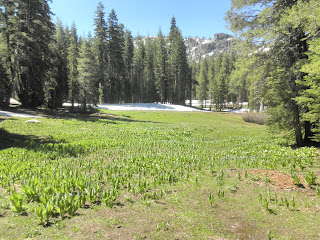
Periodically, we'd come out of the forest into a wonderful meadow filled with some kind of plant related to corn and about to burst into bloom in a few weeks. This meadow, for example, I think will be filled with flowers in week or so.
Below: And we often found ourselves standing on granite overlooks, stunned at the view of Pyramid Peak in front of us, Thunder Mountain behind us, and numerous unnamed peaks around us. {This picture does not do it justice in anyway.}


Below: This dark volcanic rock, completely different from the surrounding granite on this overlook, had apparently been hurled from the volanic peak in the background of the picture above. That volcanic explosion must have been significant because we found this rock several miles from that peak.


Below: Despite our ease with being "lost," we were all quite relieved to see this sign at last. We couldn't believe that, according to the trail sign, we'd only walked perhaps a mile or so.

We must have been far off track inour wanderings because we'd been walking steadily across country for about three hours, and the GPS noted that, at this point, we had walked 6 miles. :) We elected to continue onto Granite Lake, knowing that Hidden Lake was now too far gone in the day to try to find, so on we went, intrepid explorers we were. :)


Below: the Granite Lake rock garden: After walking past sundry smaller lakes on the trail, apparently mosquito nurseries going by the number of bites we received, the trail changed from forest trail to a granite rock garden, with a sandy texture to the trail, and we realized we were finally getting close to Granite Lake.

Below: The terrain surrounding the lake explains, of course, why the lake is called "Granite Lake." It looks like the moon (not that I've ever been on the moon).

Below: The view for lunch/snack was well worth the effort: in the background, you can see the edge of Thunder Mountain--a hike I look forward to later this summer.


Below:
the way back to the trailhead took us past this unnamed smaller yet beautiful granite lake.


Below: the view from the trail to Silver Lake--about a mile or so from the car.


Stats:

  • Distance from home: about 2.5 hours (50-Sly Park Exit--Mormon Emigrant Trail-89-Plasses Road--Plasses Resort)
  • Weather: crazy hot in the valley (100+), but on the hill, only around 80 or so. Bright sun, slight breeze, a few puffy clouds. Great hiking weather. Bring block and layer/rain jacket in case; you are on the mountain still, after all.
  • Elevation: started at 7500; highest elev: 7950/8000. [Hard to say exact mileage because we weren't sure of our exact location for much of the trip.]
  • Mileage: proposed mileage was 6.5 miles, but additional mileage/wandering resulted in 8.5 miles or so.
Tips:
If you manage to find and keep the trail, which is likely very doable if you start out on the trail and if there's no snow, here's the proposed mileage:
  • Allen Camp Trail: 1.6 miles
  • Granite Lake Trail: 3.2 miles (Hidden Lake at 0.25 mile on this trail apparently)
  • Minkalo Trail: 1.2 miles
It might be easier to find and keep the Granite Lake Trail from the north end of Silver Lake past Kit Carson Resort. It's only a mile from there to Granite Lake (yet still the lake was deserted just about. Go figure).

Additionally, be sure to take a map and compass (:) , and know how to use them. There are plenty of resources online, REI offers map and compass classes, and libraries often have books focusing on this one topic.

You'll also need plenty of mosquito repellant; I have at least 12 bites on each arm, and those are just the ones I can see. :)

Sunday, June 20, 2010

Cascade Falls and Granite Lake, Lake Tahoe, June 20 2010


Above: a great pic of Granite Lake--a small but beautiful, granite glacial baisin lake in Desolation Wilderness, opposite Emerald Bay Campground.

Wow. What a stunner today's hike was. It was one of those "hard to believe we were there" type of hikes. Off we went, then, to Granite Lake and Cascade Falls--an easy and beautiful combined hike to do on such a beautiful, early summer alpine day.

Below: our choice in trails at the trailhead.


A note about permits: "Desolation" (on the sign above) stands for, of course, "Desolation Wilderness." You'll need a Desolation permit to go to Granite Lake; you don't need a permit for the Cascade Falls hike (because it leaves Desolation Wilderness).

The permits are usually available at the trailhead, and 12 people can go under any one day permit; if you want to backpack or stay out longer than a day, you need to go to the Ranger Station at Pollock Pines or Mill Run to get your permit there.

I went to the Ranger Station on the way to the hike and picked up a few spare permits for the hikes when you need a permit, but there are none at the trailhead. I also found some great Desolation Wilderness maps which should come in handy on future hikes. It's fun to discover exactly where you are on the map and then be able to identify, with some certainty, the peaks surrounding your position. That way, you can also have a good idea of your elevation too. All good data to have, I think.

We went to Granite Lake first; we'd heard it was the harder trail, but it really wasn't. It was a good starter for the day--dirt trail with a few rock scrambles here and there. A relatively easy warm up, and although its length is not intimidating, if you add in early exposure to altitude and an unpredictable knee, it was a decent workout, after all.

This trail was not very crowded--we saw perhaps two or three other groups along the trail total--despite the huge crowds around the area. This place is a great secret to have. :)

This trail is not a flat trail; expect a steady periodically steep elevation gain which, combined with some altitude of 6600-7800 or so, can make for a decent workout.

Below: Trudging up the Granite Lake trail: you can see it's fairly steep in places.


Granite Lake was worth the hike and elevation gain, however. First, we had some stunning views of Emerald Bay itself.

Below: Here I am at one of the views over Emerald Bay.


Below: the slope you see on the left of the pic below, beyond the bay, is the lower elevations of Jake's Peak:


And then we had the beauty of the Granite Lake itself--pretty much deserted, despite its proximity to Emerald Bay, one of the most popular places in California.

Below: a view of Granite Lake through the trees. . A few patches of snow here and there, but for the most part, the snow remains only at around 7800+ feet, and even then, mostly in patches, depending on sun exposure of the slope.


Below: A picture of the hiking group at Granite Lake--a great bunch of friendly, fun folks. I was happy to hike with them.


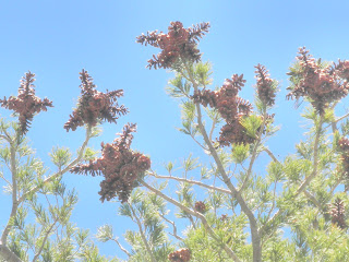
Below: Weird and wonderful star-like/angel-like pine cones, sitting at the top third of a tree near Granite Lake:


So--once we'd completed the hike to and from Granite Lake, we lightened our loads into the cars and then set out again, this time off to the left at the trailhead, toward Cascade Falls.

Below: Our first view of Cascade Falls, along the trail: they were bigger than I expected, and with the recent snow-melt after such a snowy winter, they were magnificent.


Below: the trail to Cascade Falls was mostly craggy, granite blocks and steps--similar to Echo Lakes type of terrain. Sometimes it was flattish granite slabs, however, as you can see below:


Below: A birds-eye view of Cascade Lake from the top of the falls. There's an impressive house far down on the lakeshore--we were hoping for a spontaneous BBQ invite, but no dice.


Below: Not a bad place for lunch--right at the side of the falls, in the alpine sunshine, listening to the sound of the water rushing down the mountain.


Below: A view of the side of Mount Tallac from the falls--we pass the Tallac trailhead driving to Bayview Campground.


Below: view of Freel (Peak (right) and Job's Sister (left) from the top of Cascade Falls: the group will be hiking to Freel later this summer--9 mile route on the right slope, 11 mile on the left slope. I think the group will be doing the 9 mile route.


At the top of the falls, we saw a web of multiple small feeder creeks, all going down, of course, to the falls, and beyond the creeks, we saw some intriguing open granite slabs, typical of Desolation Wilderness terrain. We, of course, wanted to explore further (and escape the crowds a little), and so we experimented with crossing the creeks until we found a log stable enough (already in the creek) to cross without too much peril.

Once over, we happily explored the granite slabs, resilient plants, the feeder creeks, tiny falls, and magnificent views. It's much less crowded once you make it over the creeks, and I felt as if I were in a National Geographic Special. The views continued to be amazing everywhere I looked.


Below: Crossing the creeks:


Below: Me on the granite slabs, once we'd crossed the creeks.
You can see the side of Mount Tallac in the background:


Stats:

Trailhead: Bayview Campground: 6880 feet elevation

Granite Lake: elev: 7670 feet.

  • 1 mile each way--dirt trail with few rock scrambling areas. Mostly shade
  • Relatively high use trail--expect to meet someone about every 10 mins.
  • Temps: low to mid 60's, but out of wind, warm. In wind at lake, chilly, but still sunny.


Cascade Falls: elev: 6550 feet
  • 1.75 mile each way--plenty o' rock scrambling, similar to Echo Lakes trail.
  • High use trail, but worth the crowds and, once there, you understand why people go there. Expect to meet someone every five minutes.


Total mileage: 5.5 miles
Elevation: between 6550 and 7670.
Drive from home: about 1 hour 44 mins

Both lake and falls are accessible via the Bayview Campground, opposite Inspiration Point Trailhead, just past Emerald Bay Campground on SR 89 North and past the Mount Tallac trailhead and Fallen Leaf campground.

To get to the trailhead, park at the back of the Bayview Campground, but arrive before ten to get a space. Other spaces are available on the side of the road, but it's a very popular area, so get there early (ie before 9:30 or 10am) on weekends or go on a weekday to avoid crowds and get a safe space.

The trail beyond Granite Lake seemed really snow-bound still. Future hikes include the Velma lakes and possible Eagle Falls (although those falls look incredibly crowded).

This hike was a mixture of Trail #28 and 29 in Top Trails Tahoe.

All in all, a stunner of a hike. Well worth the trip. It's not a long hike, but I felt pretty worked out at the end of it, and because it wasn't a huge number of miles (only about five), I got home at a decent time--with enough hours in the day left to write this blog entry. :)

Sunday, May 16, 2010

My Bledsoe Brace

Above: this is a picture of what appears to be the same knee brace I use for hiking--the Bledsoe Axiom-OA Custom. Mine is black, but it comes in a variety of colors, depending on your wardrobe choices. :)

I love my brace. I use it for all my hikes (and for local neighborhood walks), and I find it essential to keep my femor and my tibia (shin bone?) in place. With loose ligaments, those two sometimes find it hard to play well together, and the brace returns them to alignment (and keeps them there) which makes things more comfortable for me.

One caveat: I think these things are expensive; mine was custom-made and covered, fortunately, by insurance. They're possibly around $400+ otherwise. Still, if the brace buys you enough independence as mine has bought me, it might be worth it?

These braces last a long time too. I've had mine now for four years of frequent use (most days for at least an hour or so each day--often six to seven hours many days), and it shows no sign of wearing at all. I call it my exo-skeleton; it's pretty comfortable once you get the straps well fitted, and it's fairly light as functional braces go. Football players and contact sports players wear this type of brace, so I'm very confident that it will support and protect my knee in all my activities.

The brace is also pretty adjustable; I've worn mine over shorts and pants, and with the adjustable velcro knee and thigh straps, I've still managed to achieve good comfortable support.

Anyway, without it, I couldn't do what I want to do, so cheers to Bledsoe for a great brace and thanks to the orthopod who ordered it for me. :)

Here's the info link if you'd like more info: http://bledsoebrace.com/products/axiom_oa.asp

Saturday, May 15, 2010

Knee MRI on Monday

I will be having a knee MRI on Monday morning to see if the knee problems are, indeed, as both the surgeon and the PT suggest, ACL, LCL, and/or PCL tears.

I originally hurt my knee three years when I tripped over (myself) in a softball game at work--my first and last softball game, to be honest. When I fell, I landed on both bent knees and both outstretched arms--on all fours, really. As a result, I broke my elbow (which I knew immediately) and tore my PCL (which I realized the next day). [When I do something, I'm usually pretty thorough. :) ]

My elbow is mostly fine now, but my knee remains a problem-hence the MRI on Monday. I've done all the conservative measures--months of PT, years of gym work on the bike and building quads, no running etc etc, but still the knee feels unreliable most of the time.

I won't know the MRI results until possibly my PT appointment on Friday next or (more likely) the orthopedist appointment on June 4.

Either way, early on Monday morning, I get to lie inside a clanking, tapping, giant magnet that takes cool pictures of my knee. Talk about "thin-slicing" (a la Blink by Malcom Gladwell).

Sunday, May 9, 2010

Alamere Falls, Point Reyes National Seashore, May 9 2010

Maria and I went for a Mother's Day hike today to Alamere Falls in Point Reyes, and what a wonderful hike it turned out to be. This view above, typical of the views on a sunny May day in Point Reyes, shows the wildflowers, out in force, on the approach to Wildcat Beach.

A stunning, stunning, stunning day.

Our chosen route: Palomarin Trailhead--Coast Trail--Ocean Lake Trail--Wildcat Camp--Wildcat Beach to the falls.


You can get a choice of maps from from Bear Valley Visitor Center; I would get the free black and white map on big paper. It has mileage and very clear trail indicators. Check also the tide timetable at Bear Valley Visitor Center or online. You'll want to walk along Wildcat Beach for a mile if you want to get to the bottom of the falls without going through poison ivy.

Below: the Palomarin Trailhead sign; the trail has lots of signs indicating direction; with several options to get to Alamere Falls, it's worth reviewing a trail map to help you plan your route.


Below: the early part of the trail is on hard packed dirt, but later parts vary from angular granite, to loam, to sand. The trail has plenty of poison ivy and stinging nettles, but they're off to the side of the trail, so they're easy to avoid.


Below: my first banana slug. Apparently, you're supposed to put the slug on your hand and lick it. Since I'm not a UC Santa Cruz alum, I didn't have to do that. :) The slug is next to Maria's new hiking shoes for size comparison.


Below: an early indicator of direction for Wildcat Campground--an area with beach access to Alamere Falls.


Below: getting closer!


Below: one of four wooden bridges on this hike--lots of creek crossings but all with bridges, so no wet feet.

Below: One of two largish lakes you pass on the Ocean Lakes Loop Trail. This one below is Pelican Lake on the way to Wildcat Beach.


Below: first glimpse of Wildcat Beach from the Coast Trail.


Below: Looking North at a foggy view of Arch Rock, north of Wildcat Beach. The fog, while present at the higher hills, didn't touch our hike at all; instead, if you looked to the left (south), our direction of travel, we had light wispy clouds and a bright blue sky.


Below: our view for lunch; we sat on camping logs and enjoyed couscous (thanks, Maria!), hummus, and drinks. A wonderful place for lunch with great company in a stunningly beautiful locale. People travel from all over the world to this park. We're blessed to be able to visit it so easily.

Below: Maria and I were thrilled with the walk along Wildcat beach toward the falls; the sunshine, the warm temps, the stunning scenery, the deserted beach; we decided that there was nothing better for this wonderful day.


Below: the view toward Alamere Falls; the beach was steaming because the air was so warm.


Below: Approaching Alamere Falls--they're already looking cool and impressive, even from a distance.


Below: 'skull' rock--an interesting rock on the beach with holes bored into it from sea/stone action over time.


Below: the bottom of the falls, where the fresh water meets the sea on Wildcat Beach.


Below: here I am, enjoying the view of Alamere Falls. Lots of water sounds--the crash of the ocean waves mixed with the constant roar of the waterfalls, leading to a very enjoyable snacking area. :)

In this pic below too, you can also see my Bledsoe brace, for which I am supremely grateful and without which I wouldn't be able to complete my hikes. It's my exo-skeleton--custom-made, very comfortable, and essential for my knee.


Below: On the way back to Wildcat Camp, a view toward Arch Rock.


Below: more Arch Rock views from Wildcat Beach; the clouds, while threatening, dissipated rapidly, leaving only sunshine and blue skies.


Below: field of wildflowers (wild mustard) at Wildcat Camp.


Below: more wild mustard fields, including cow parsley--a blast from the past for me. Just behind me, later on the hike, we saw a fawn, taking gigantic yet inefficient mostly vertical leaps to get away from us. Gangly legs and curious eyes-enchanting little guy.


Below: one of a series of unending amazing views on this hike. This view, on the way back, is looking north toward Arch Rock.


Below: the trail on the way back, looking toward Palomarin Beach, the access to which is 0.6 miles from the Palomarin Trailhead.


Stats:
  • Weather: prediction was awful--thunder storms, 54 degrees. Reality was wonderful--layers, of course, since it's Point Reyes, but at least some of the day was in t-shirts with block on. The rest of the day was a long sleeve fleece with sometimes a fleece vest. No rain although it dumped in Novato about an hour earlier.
    Trail: mix of loam, sharp granite, loam, wet mud, and sand. Faily steep in places and most often up and down. Not much flat, so be prepared.
Mileage:


  • Palomarin Trailhead: 0

  • Coast Trail: 4.2

  • Ocean Lake Loop: 1.3
  • Wildcat Beach: 1
Return:
  • Wildcat Beach: 1
  • Coast: 5.5
  • Palomarin Trailhead: 0
Total: 13 miles
Time: 6 or so hours, including an hour or so for taking pix, enjoying the views, eating lunch, and sitting by the falls. Plenty of up and down, but nothing huge. Not flat, though, so be aware of that.

More info? http://www.nps.gov/pore/planyourvisit/index.htm

Sunday, May 2, 2010

Optimism


Well, I'll tell you where I haven't been recently and much to my chagrin. Hiking.

I have been grading, working, attending my son's baseball games, and going to gigs, so I've had a good mixture of work and family time, but still--no hiking.

And I so need to hike. In a big way. I just need to walk and walk and walk for a few hours. Outside. In the air. In the quiet. In nature--to catch up.
So--I plan to go out this upcoming weekend, hopefully to the coast, to blow away the cobwebs and to see some sights, hear some sounds, and do some 'sploring.

I cannot, cannot, cannot wait.